by Celeste Lipford and Terry Lipford - last updated on 5/29/2025

We had to travel to Springfield, MA for a family funeral, and while the occasion was a solemn one, we saw an opportunity to reconnect with familiar places and explore new destinations in New England. After the service, we decided to embark on a driving trip through the region, revisiting places that hold personal significance and discovering new spots that had long been on our list.
As outlined in our route map (click here to go to that section of this page), our plan was to strike a balance between nostalgia and adventure. Some locations were places we had visited before but wanted to experience more fully, while others were completely new to us—destinations we had always hoped to explore. Each stop along the way was chosen with intention, whether for its scenic beauty, historical value, or personal connection.
Our journey would ultimately lead us back to the Plymouth, MA area, where we could spend time with family and take the opportunity to visit my sister’s family on Cape Cod. This trip wasn’t just about the miles covered but about reconnecting with memories, creating new ones, and appreciating the rich history and landscapes of New England.
It's only slightly bigger than the State of Washington: though New England is home to a half-dozen states and about 14.8 million people, its total area of 71,991.8 square miles means it is only slightly larger than the state of Washington.
Yes, Boston's Subway was the First in the Western Hemisphere. Opened on September 1, 1897, Boston’s Tremont Street Subway became the first underground rapid transit system in North America.
Maine has more Coastline than California: though it may seem hard to believe, the New England state of Maine actually has more coastline than California. Maine boasts 3,478 miles of coastline. When you include all of Maine's islands it has more than 5,000 miles of coast. The Golden State on the other hand has 3,427 miles of coastline.
Maine is nearly as big as the other five New England States Combined: Maine's size can be deceptive. In addition to all of that coastline, the New England state has a total area of 33,215 square miles. That means it's almost as big as all of the other five New England states put together, which cover 36,293 square miles. Maine has over 3,500 miles of coastline (including islands), more than California!
Connecticut is famous for its rich history, innovation, and scenic beauty. It was home to the first hamburger, first nuclear submarine, and first telephone book. Yale University and historic authors like Mark Twain and Harriet Beecher Stowe add to its cultural significance. The state has a strong maritime and shipbuilding history, with Mystic Seaport and Groton playing key roles. It’s also known for wealthy towns like Greenwich, fall foliage, and New England charm. Connecticut is home to ESPN, UConn basketball dominance, and Revolutionary War hero Nathan Hale.
Harvard served as a Military Barracks during the Revolutionary War.
Yes, Connecticut is home to the Country's Oldest Public Library: The Scoville Memorial Library in Salisbury, Connecticut.
Yes, in 1939, Maine passed legislation to make it illegal to put tomatoes in clam chowder.
Yes, Vermont has the most breweries (per capita) in the United States: With 19 breweries and a 2008 population of 621,270, that makes one brewery for every 32,698 people, the most per capita in the country. Maine is fourth on the list.
The New England Colonies got their names for a variety of reasons. Massachusetts was named after a tribe, with the name meaning 'large hill place'. Connecticut was named for an Algonquin word meaning 'beside the long tidal river.' Rhode Island was named for a Dutch word meaning 'red island.' New Hampshire was named for a county in England.
Maine supplies 90% of the country’s lobsters, making it the Lobster Capital of the U.S.
New England is home to over 200 covered bridges, Vermont alone has more than 100, many dating back to the 1800s.
We flew into Bradley International Airport from our home in Florida - we did not stay here, but quickly obtained our rental car and proceeded to Springfield, MA.
We are going to skip over our stay in Springfield, MA as we were there for a private family matter.
Image Credit: This image is the property of Bradley International Airport from their website.

On the way to Cannon Mountain we stopped in Hanover for our second breakfast. Having woken up at 5 AM to drop the kids at the airport it was only about 9 and we were starved. We found several restaurants, a bakery and Starbucks. We decided to eat at Lou’s bakery where everything was homemade. Check out our scone...yummy.
Image is the property of the Hanover, NH Website
Main Street Hanover: Frequently listed as one of the most charming small towns in New Hampshire (population of just 8,508 in 2019). Hanover was chartered by Governor Benning Wentworth on July 4, 1761, and in 1765–1766 its first European inhabitants arrived, the majority from Connecticut. Although the surface is uneven, the town developed into an agricultural community. Dartmouth College was established in 1769 beside the town common at a village called "the Plain" — an extensive and level tract of land a mile (1.6 kilometers) from the Connecticut River, and about 150 feet (46 m) above it.
It was a pleasant surprise to find that Dartmouth College is located in Hanover. We only discovered it because there was a t-shirt shop on main street full of Dartmouth College gear. We took a walk down Main Street and found the college immediately at the north end. Dartmouth is an Ivy League school and the 9th oldest college in the United States. It was established in 1769 by Eleazer Wheelock and is one of the nine colonial colleges chartered before the American Revolution. By coincidence, my first wife was related to Eleazer Wheelock. Dartmouth college also has a deep rowing history with a rowing program that started in 1833. Our son had the privilege of racing against them several times during his tenure rowing for Syracuse University.
More Info for Hanover
Image Credits:
All of the above images are the property of Just Traveling Thru, LLC.

If you enjoy our videos, please click here to subscribe to our Youtube Channel.
Cannon Mountain is a 4,080 foot peak located in the White Mountains of New Hampshire. In the winter it is a popular ski resort and in the summer you can ride the Aerial Tram to the summit and walk to the observation tower to take in the views. On a clear day you can see for a considerable distance, including Mt. Washington, the Green Mountains of Vermont and Kinsmans to the south.
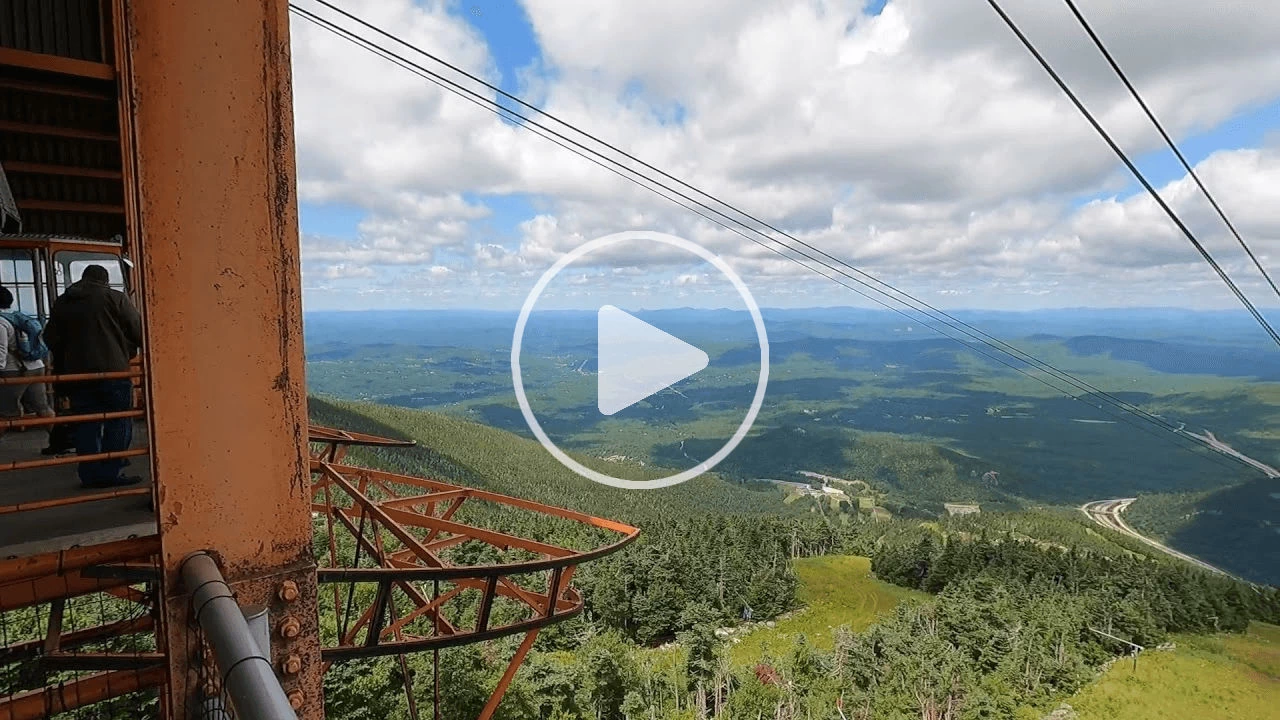
As you can see from the images below, the views from the Aerial Tram and from the short walk to the observation tower are beautiful, on a clear day you can see for a considerable distance - Mt. Washington included.
The above video poster image can be clicked to view one of our YouTube Videos we created for our ride up to the top where the hiking trail and observation tower are located.
The Cannon Mountain Aerial Tramway, located in Franconia Notch State Park, holds the distinction of being the first passenger aerial tramway in North America, opening to the public in 1938. This engineering marvel continues to attract visitors from across the country, offering a unique and thrilling ride to the mountain’s summit, making it a must-see attraction in New Hampshire’s White Mountains.
The tram swiftly ascends to the 4,080-foot summit in under 10 minutes, providing breathtaking views of the surrounding mountains, valleys, and even into parts of Vermont, Maine, and Canada on clear days. Once at the top, you can explore a variety of scenic walking paths, perfect for those wanting to take in the natural beauty at a leisurely pace.
One of the highlights at the summit is the 360-degree observation deck, which offers stunning panoramic views of the White Mountain National Forest and beyond. It's the ideal spot to take in the majestic landscapes, snap photos, and soak up the fresh mountain air. For those seeking a bit of relaxation, there is a summit café that serves drinks, snacks, and light refreshments. The café’s hours are 9 a.m. to 4 p.m., making it a convenient stop for a bite to eat while enjoying the spectacular scenery.
Restroom facilities are also available at the summit, ensuring a comfortable experience for visitors. Whether you're an avid hiker, a nature enthusiast, or simply someone who appreciates a breathtaking mountain view, the Cannon Mountain Aerial Tramway offers an unforgettable experience that showcases the best of New Hampshire’s natural beauty.
NOTE: Specific date & time advance reservations are required to ride the tram. Click here to go to the Tram Website reservation page.
The Cannon Mountain Rim Trail is a must-do hiking experience for visitors to Franconia Notch State Park. The trailhead begins just outside the Tram Summit Station, making it a convenient adventure for those who take the Cannon Mountain Aerial Tramway to the top. The Rim Trail offers a gentle and accessible path that takes hikers to the observation tower at the mountain’s summit, providing breathtaking panoramic views along the way.
Unlike some of the more challenging hikes in the White Mountains, the Rim Trail is relatively easy with little elevation gain, making it suitable for families, casual hikers, and anyone looking to enjoy the stunning scenery without a strenuous climb. The path is well-maintained, and there are frequent scenic viewpoints where you can pause to take in the spectacular vistas of the surrounding mountains, valleys, and lakes.
The trail leads to the 360-degree observation tower, one of the highlights of Cannon Mountain. From this vantage point, hikers are rewarded with unparalleled views of Franconia Ridge, Mount Lafayette, Mount Washington, and even into Vermont, Maine, and Canada on clear days. The observation deck is the perfect spot for photography, relaxation, and soaking up the natural beauty of the White Mountains.
Along the trail, you’ll also encounter interpretive signs that provide information about the local flora, fauna, and geology, adding an educational element to your hike. Keep an eye out for native wildlife and alpine vegetation, which are unique to the higher elevations of the region.
Cannon Mountain Observation Tower: On a clear day the views from the tower are 360°, however even though we were there on a summer day, the breeze was strong and chilly! This historic tower, perched atop New Hampshire's Cannon Mountain, offers unparalleled views of the Presidential Range and surrounding landscapes.
More Info for Cannon Mountain
Image Credits:
All of the above images are the property of Just Traveling Thru, LLC.
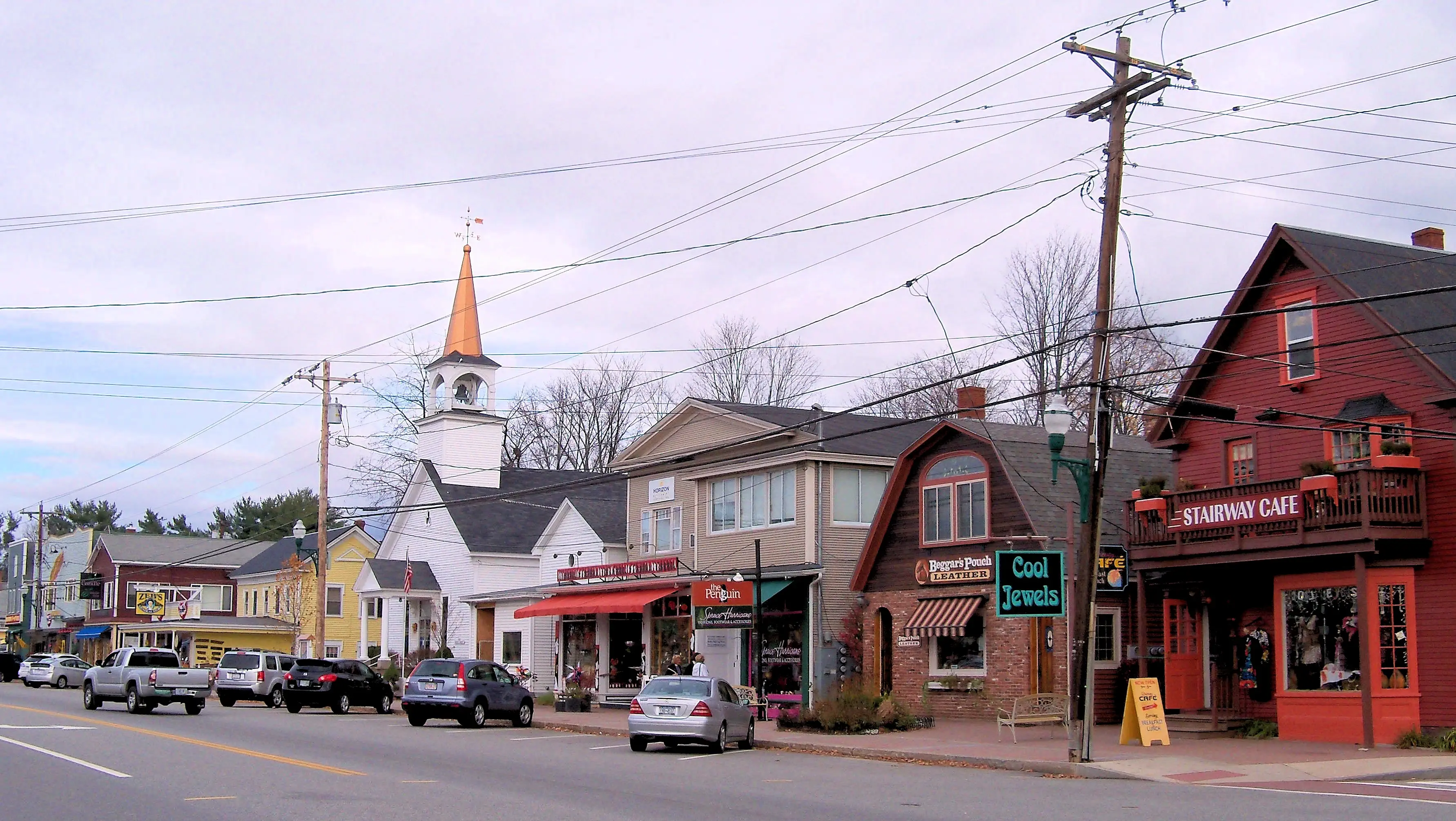
 North Conway, NH - Above image is the property of AlexiusHoratius via Wikipedia Commons using the CC BY-SA 3.0 license.
North Conway was on our list of places to visit because we honeymooned there in 1989. We were so broke then that we couldn’t afford to go on a traditionally expensive vacation. We rented a condo for a weekend and skied Black Mountain after being married by a justice of the peace in Groton, Massachusetts. We had a great honeymoon there and hadn’t been back since. North Conway has not changed much since then.
North Conway is truly a family destination with lots to do. Within driving distance you can visit the white mountains including Mount Washington and the Mount Washington cog train, numerous hiking trails in the White Mountains National Forest, Storyland, the North Conway Scenic railroad, and several mini-golf places.
Kancamagus Highway & Swift River: After our Cannon Mountain exploration, we took a leisurely drive south on the Kancamagus Highway to reach North Conway, NH. The highway parallels the Swift River and we wound up stopping several times to get some pictures.
Hampton Inn & Suites North Conway: We do not normally talk about accommodations, but this hotel was not only comfortable, it had a really nice pool & play area that we thought anyone reading this page might be inclined to give this hotel a try. The large pool & water slide area is a great way to keep the kids entertained after a busy day exploring.
Yes we do advertise for Hilton Hotels, but this is not about "advertising", it is all about this hotel being a nice play to stay. Take a look at the Google Reviews for this hotel below.
NOTE: The 3 hotel images are the property of Hilton Hotels.
More Info for North Conway
Image Credits:
All of the above images are the property of Just Traveling Thru, LLC.
We weren’t sure what we would do when we got to North Conway so we picked up a local tourist magazine and noticed several hikes in the White Mountain National Forest. The hike to Arethusa Falls caught our attention. We tend to like hikes with a payoff at the end. We weren’t sure that Terry would be able to complete the hike since he just had his hip replaced in April but we decided to give it a try.
We saw a sign that displayed several ways to get to the falls, we used the Arethusa Trail. The trail to the Arethusa Falls (the tallest waterfall in New Hampshire). is continuously steep and rugged and is rated as "difficult" by the All Trails website and you will find other sites claiming that it is "moderate". Bring your own water and good shoes, as the trail is covered with ruts, roots, rocks and requires you to be cautious.
You can see that Google Maps is not very accurate at rough terrain hikes, as the trail distance from the parking lot to the falls is 1.4 miles with a nearly 784 foot increase in elevation. Surprisingly, the trail was moderately busy with many family groups including children and dogs.
There is some debate, however, over the height of the waterfall, believed to be the tallest in New Hampshire. AMC’s White Mountain Guide lists the falls as “nearly 200 feet,” while New England Waterfalls estimates 160 feet.
This is a steep trail, and having the use of good walking sticks is very useful, click here to take a look at some REI walking sticks that would be worth your consideration.
If you are looking for high quality Camping & Hiking, Climbing, Cycling, Water, Fitness, Snow or Travel gear - take a look at REI. REI Co-op Members get free U.S. standard shipping — no minimum order required. Take a look at their website for more information.
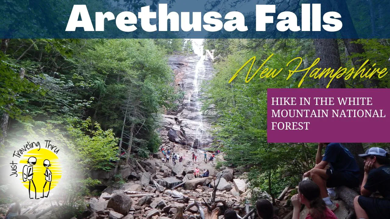
 Click this image to watch a video of
our Arethusa Falls Hike. This video is the property of Just Traveling Thru, LLC.
 Our video gives you the information you need to hike Arethusa Falls in New Hampshire. Arethusa Falls sits just northwest of North Conway, NH and is one of the tallest waterfalls in the state. The hike is just 2.8 miles out and back with a big payoff at the end. It's great for families with children and pets and even us old folks. Check out the video to see how to get there and get a sense for what you will run into during the hike.
Bar Harbor has been one of our favorite places to visit in Maine for quite a while. The beautiful harbor, beautiful beaches & forests, and great seafood around every corner - what is not to like?
Bar Harbor Cruise Ship Controversy: Bar Harbor is actively working to reduce cruise ship visitation due to concerns about the town’s quality of life, environmental impact, and infrastructure strain. The push to limit cruise traffic grew during the pandemic and culminated in a voter-approved ordinance in 2022. This ordinance caps daily disembarkations from cruise ships at 1,000 passengers, a sharp decrease from the previous 3,500–3,700. The town has cited issues such as overcrowding, stress on local resources, and the negative effect of mass tourism on Bar Harbor's small-town character as driving forces behind these measures.
Come on over and take a look at our Bar Harbor page and you will be able to view for yourself what this pretty little town is all about.
The park is spread out over 47,000 acres along Maine's rugged coastline, offering stunning landscapes, including granite peaks, dense forests, and pristine lakes. Visitors can hike trails that range from easy walks to challenging climbs, with some leading to the summit of Cadillac Mountain, the highest point on the U.S. East Coast, offering breathtaking sunrise views. The Thunder Hole is a not to be missed spectacle, especially when the waves are high.
Acadia National Park also offers diverse wildlife, from peregrine falcons to white-tailed deer, making it a haven for birdwatchers and animal lovers. Scenic drives like the Park Loop Road provide incredible views of the Atlantic Ocean and the rocky shoreline. Visitors can also enjoy biking on the historic Carriage Roads, kayaking in peaceful waters, or relaxing on Sand Beach.
We invite you to take a look at our Acadia National Park page where you can explore the rugged coastal landscapes, granite peaks, and serene forests.
Note: All images featured on this page are the exclusive property of Just Traveling Thru, LLC, unless otherwise stated. When images from external sources are used, full credit is given to the original creator, along with a link to the specified license or usage terms. We are committed to respecting copyright and intellectual property rights, ensuring that all third-party images are properly attributed. If you have any questions regarding image ownership or usage rights, please feel free to contact us.
Affiliate Links: We may earn a commission if you make a purchase through one of our affiliate links. This helps support our travel content — thank you!
Content: To review any of our content, make suggestions and/or comments, please click the "About" menu link at the top of this page. You will find our "Contact Us" link on that drop-down menu.