


A Southern California Adventure
San Diego and Southern California Exploration
by Celeste Lipford and Terry Lipford - last updated on 5/7/2024
 This was a combined "business & pleasure" trip, as Celeste needed to be there for a technical conference at the San Diego Convention
Center and I came along because I spent my first year in the Navy there (boot camp & Radioman "A" School) so naturally I was interested
in visiting those places once more.
This was a combined "business & pleasure" trip, as Celeste needed to be there for a technical conference at the San Diego Convention
Center and I came along because I spent my first year in the Navy there (boot camp & Radioman "A" School) so naturally I was interested
in visiting those places once more.
We flew into San Diego and took a taxi to our hotel. We did not plan to obtain a rental car until the following weekend, as we planned to restrict ourselves to those places we could get to by walking. In fact, we had selected the Homewood Suites by Hilton due to it\'s location near the harbor, close proximity to Balboa Park (and the zoo), adjacent to the Little Italy area, and reasonably near to the old Naval Training Center site. An added plus was that the San Diego Metro System was only a block away, so Celeste would be able to ride the Metro or take a taxi to the Convention Center each day.
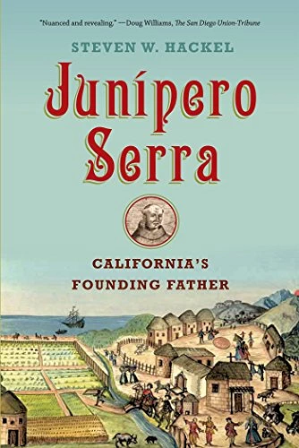
For a fascinating look at the earliest days of San Diego & California, you should consider reading the history of Saint Junípero Serra y Ferrer. He founded 21 Catholic Missions from San Diego to San Francisco, starting this process in 1768 at the age of 55.
NOTE: Click here to view the Wikipedia Article about San Diego.
San Diego is a beautiful city with a lot to offer visitors. There are many reasons why people choose to visit San Diego, including the following:
- The weather is great year-round, with mild temperatures and plenty of sunshine.
- There are a variety of beaches to enjoy, from the popular Pacific Beach to the more secluded La Jolla Shores.
- The city is home to world-class attractions like the San Diego Zoo, SeaWorld San Diego, and Legoland California.
- There are plenty of opportunities for outdoor activities like hiking, biking, and kayaking.
- San Diego has a vibrant nightlife scene with bars, clubs, and restaurants to suit all tastes.
- The city is also home to a number of museums and cultural attractions, such as the San Diego Museum of Art and the Old Globe Theatre.
- San Diego is a great place to relax and enjoy the laid-back California lifestyle.
More Info about San Diego
- The first ever drive-thru restaurant, Oscar’s, opened in San Diego in 1951. The restaurant owner later went on to found Jack in the Box.
- The largest oceanographic museum in the USA is within the borders of San Diego. It’s the Birch Aquarium at the Scripps Institution of Oceanography.
- The San Diego Zoo, located within Balboa Park, houses over 3,700 animals and more than 650 species. The zoo is one of the few zoos in the world that successfully breeds the giant panda.
- San Diego produces more avocados than any other city in California.
- San Diego history is a long but interesting story.
- Father Junipero Serra founded the Mission San Diego de Alcala in 1769 - it is the oldest Mission in California.

Where to stay in San Diego


Homewood Suites by Hilton San Diego/Bayside
There is always a rise in hotel prices in most U.S. Cities when a major convention is taking place, and San Diego was no exception. We wanted to be near the harbor, and secondarily I wanted to be within hiking distance of the old Naval Training Center.
While planning this trip, we had decided upon the Homewood Suites by Hilton San Diego/Bayside. This was an easy decision, first because we have a lot of good experiences with Homewood Suites and secondly because it fit our requirements perfectly, ie; one block from the nearest Starbucks, two blocks from Little Italy (where numerous good restaurants can be found), one block from the Harbor and a 3.2 mile hike to the old Naval Training Center grounds. The fact that the hotel was relatively new was icing on the cake, as the rooms & facilities were good sized & very clean.
This particular hotel is a new concept that Hilton is trying - part of the hotel is a Homewood Suites with true suite setup and the other part of the hotel is a Hilton Garden Inn with standard hotel rooms. The hotel offers a small pool & fitness area, a complimentary breakfast and a small pub/restaurant.
While plotting our San Diego adventures, we discovered that Balboa Park & the San Diego Zoo were but a 2.1 mile hike from our Hotel - and since both of those sites were on our "to do list" that became our first outing.
With the hotel located on Hawthorne Street, our hike started with a stroll to 1st Avenue where we turned north to Laurel Street, then turned east (right) again and walked into Balboa Park over the Cabrillo Bridge.
NOTE: Both of these images are the property of Hilton Hotels
NOTE: So if you are not a Hilton Hotels enthusiast, here is a link to have Google find hotels for you in San Diego; click here
Balboa Park along El Prado - Entering the Park at the Cabrillo Bridge Entrance Map


As I described previously, we entered via Laurel Street which brings you into the park on it's western side. The Cabrillo Bridge vista is very pretty, and there are large public park areas on both sides of the road - including a large dog park (Nate's Point Dog Park) on the southern side of the road.
Balboa Park, located in the heart of San Diego, is a vibrant and captivating destination that showcases the city's cultural and natural beauty. Spanning 1,200 acres, this urban oasis is home to a remarkable array of attractions, making it a must-visit for locals and tourists alike. The park's crown jewel is the stunning Spanish Colonial-style architecture, which serves as the backdrop for numerous museums, including the renowned San Diego Museum of Art, the Natural History Museum, and the Fleet Science Center.
Placed in reserve in 1835, the park's site is one of the oldest in the United States dedicated to public recreational use. Balboa Park is managed and maintained by the Parks and Recreation Department of the City of San Diego.
Laurel Street turns into El Prado once you walk into the Park entrance on Sixth Avenue. This is an interesting way to get to the Zoo, because you will walk through the Museums area, several restaurants and various other places of interest.
 San Diego Museum of Man
 Balboa Park Visitors Center
 Botanical Building
More Info for Balboa Park
- Balboa Park Website: here is a link to their website.
- Balboa Park Google Images Set: Here is a link to that Google Images Set.
- Balboa Park Wikipedia Article: Here is a link to that article.
- Balboa Park Map Here is the Google Map link.
San Diego Zoo Map


The San Diego Zoo is one of the largest zoos in the United States, you can easily find just about any animal that you may want to see here ! Here are just a few of the amazing zoo statistics;
- More than 12,000 rare and endangered animals.
- More than 650 different species.
- It's parent organization, San Diego Zoo Global, is one of the largest zoological membership associations in the world.
- It is the most visited zoo in the United States.
- It previously had the largest population of giant pandas in North America, they have all since been returned to China.
- It is famous for its breeding colony of koalas, the largest one outside of Australia.
This is a zoo that is fascinating in many respects, you should plan to spend at least a full day exploring! Be sure to wear comfortable walking shoes, as the zoo has some steep trails - or plan to ride one of the many zoo tour rides.
The Zoo was a pioneer in the concept of open-air, cageless exhibits that re-create natural animal habitats. It is one of the few zoos in the world that houses, and successfully bred the giant panda, although the pandas have recently been repatriated to China. In 2013, the zoo added a new Australian Outback exhibit, providing an updated Australian animal experience. Another new exhibit, called Africa Rocks, opened in 2017.
More Info for the San Diego Zoo Map
- San Diego Zoo Tickets: Here is a link to the Zoo Website Purchase Tickets Page.
- San Diego Zoo Google Images Set: Here is a link to that Google Images Results Page.
- San Diego Zoo Map: Here is a link to that Google Map Page.
- San Diego Zoo Website: Here is a link to their Website.
- San Diego Zoo Wikipedia Article: Here is a link to that Article Page.
San Diego Bay Area Map


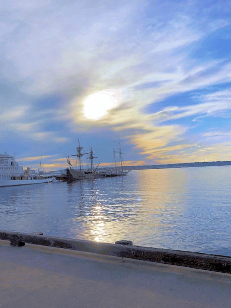
All of the above images were taken as we explored the Harbor Boulevard area from the hotel south to the Tuna Harbor Park - directly opposite the USS Midway Aircraft Carrier Museum. The Fish Market Restaurant is located at the western edge (bay side) of the peninsula. We wound up having dinner there, and were glad we did.
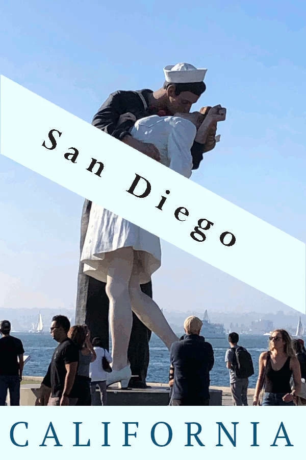
For those of you who have visited Sarasota, FL - yes the Unconditional Surrender Statue in Sarasota is part of the Seward Johnson series. You too can own one, prices start at $542,500 for styrofoam, $980,000 for aluminum, and $1,140,000 for bronze. And just for the record, the Sarasota Statue was installed in 2005 and the San Diego Statue was installed in 2007.
Liberty Station Map


Naval Training Center Site
I described earlier on this page how one of the "hotel selection criteria" was to be within walking distance of the Training Center site. It turns out that I picked perhaps "not the best day" of the week to hike over there from the hotel, as the high that day reached 90 degrees! What made the hike much easier, is that there are two parks along the way; "Cancer Survivors Park" and "Spanish Landing Park East" and both parks have frequent water fountains and rest rooms. I otherwise might have abandoned the hike and called an Uber to get back to the hotel, as the 90 degree day made it a sweaty walk!
One of the very few "Navy things" that remain on the old Naval Training Center Site is the USS Recruit, a cement & steel replica of a (a 2/3 scale model of a Dealey-class destroyer escort) WW2 era ship. New Recruits were brought here to learn various skills and to become familiar with what "port & starboard" meant. The rest of the site (over 361 acres) was acquired by the city of San Diego (through a master lease agreement) and is now a multi-purpose area. The site is now called "Liberty Station".
For anyone interested in the history of the Naval Training Center San Diego, a good decade by decade timeline can found here. The short version is that the base was authorized in 1921, took two years to construct and the opening ceremy took place on June 1, 1923. The base was included in the "Base Realignment and Closure Act" base closings announced on July 5, 1991. The city of San Diego began public discussions in 1996 to determine what the future of the base should be - and the result was "Liberty Station" as described above.
IMAGE CREDITS: Image # 2 above is the property of the U.S. Navy (Public Domain 1980). All other images are the property of Just Traveling Thru, LLC unless otherwise noted.
More Info for Liberty Station
- Liberty Station Google Images Set: Here is a link to that Google Images Results Page.
- Liberty Station Map: Here is a link to that Google Map Page.
- Liberty Station Website: Here is a link to their Website.
- Liberty Station Wikipedia Article: Here is a link to that Article Page.
Aliso Viejo California Area Map


Part of the reason for visiting this area, was that we were on the way back from visiting some very good friends of mine in Manhattan Beach, CA. I had made arrangements to visit them once the technical conference concluded in San Diego, so on Friday morning we checked out of the hotel and drove north to the Los Angeles area. Although it was great to see old friends once again, I have to admit that the Los Angeles traffic is just as bad as it was when I lived there!
We had reservations at the Aliso Viejo Homewood Suites (another very comfortable hotel Mr. Hilton !) because it was adjacent to an area full of restaurants and 6.6 miles from Laguna Beach where we planned on doing some hiking and some nostalgia exploring.
So even though this hotel was very comfortable, it really just became a place for us to spend the night, as we had a lot of things we wanted to see and do while we were in this area.
NOTE: Both of these images are the property of Hilton Hotels
Crystal Cove State Park Map
Crystal Cove State Park is located 2.8 miles north of Laguna Beach on the Pacific Coast Highway (CA-1). The hiking area is on the right side of the highway, and the beach area can be entered just a 1/2 mile further north on the left side of the highway. There is a good sized public parking area on the beach side, but the hiking side has limited parking - so you have to arrive early if you want to park there.
The hiking area of the park is 2,400 acres with a total of 17 different hiking trails that branch off of 3 centralized routes, and visitors are allowed to use them for hiking as well as cycling and horseback riding. The “Perimeter of the Park” trail rises to over 1,000 feet above sea level from the parking lot at 35 feet above sea level.


Our plan was to trek the "moderate loop trail" because at 2.85 miles and a rise from 35 feet above sea level to 550 feet above sea level we could enjoy the hike and not expend an entire day's worth of energy there! The rise in elevation was indeed moderate but continous, and we enjoyed the scenic views of the surrounding area as well as the Pacific Ocean.


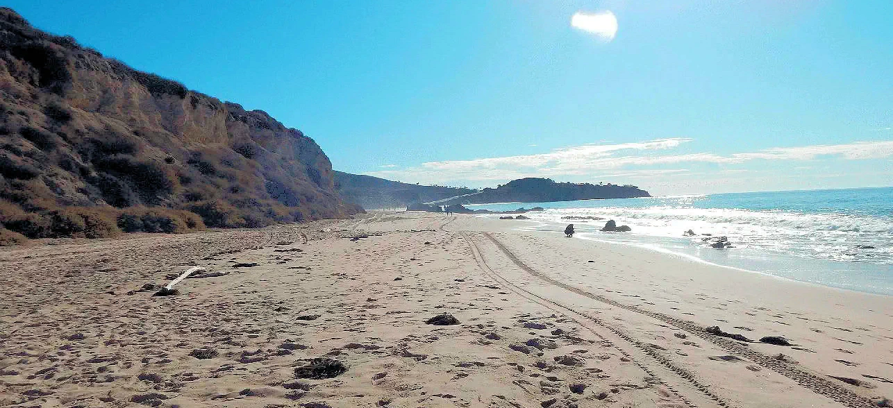
We initially thought that we could just walk down from the hiking parking area and cross the highway to reach the beach. Nope, no way to cross over. So we went back and got the car and drove 1/2 mile to the beach area parking lot. As you can see in the above images, the walk down to the beach is very steep but California thoughtfully provides a stout hand-rail all the way down.


Beach Access from the Parking Lot
Remember above where I described getting to the beach as "steep"? I do not know what this elevation is and admittedly the walk is only perhaps 100 yards long, but the descent is continuous and the hand-railing is very useful!
I could not locate any information regarding the height of the parking lot above the beach, but it had to have been perhaps 200 feet or so above sea level. This is the kind of beach that makes people want to visit California; edged by cliffs, beautiful view out over the Pacific Ocean and the occasional pile of rocks along the water's edge.
More Info for Crystal Cove State Park
- Crystal Cove Map: Here is a link to a Google Map.
- Crystal Cove Google Images Set: Here is a link to that Google Images Results Page.
- Crystal Cove Website: Here is a link to their Website.
- Crystal Cove Wikipedia Article: Here is a link to that Article Page.
- Crystal Cove visit Cost: Day use is $15 per vehicle and $20 on summer weekends and holidays. For annual, seasonal, veteran discounts and other pass descriptions see California Parks Website. Is there an hourly parking rate? Yes, $5 per hour parking is available year-round at the Los Trancos parking lot through the Yodel Parking app.
Laguna Beach Map


After our hike and beach exploration, we felt that we had earned a snack or maybe even an early lunch. Since our game plan was to next explore Laguna Beach, we decided to lookup where we might get a coffee and a light lunch and we found the Blk Dot Coffee Shop. This was a great choice, the owner himself brought our food to our table and everything we had was excellent. When I decided to file a Trip Advisor review of this nice shop, I discovered that they did not yet have an entry, so I created one for them and sent them a message to let them know of what I did.
Laguna Beach is a small city, the population estimate in 2017 was 23,174. As the city is located right on the shores of the Pacific Ocean with the coastal hills rising away from the shoreline, most homes are built either on the sides of the hills or on top of them. There are a number of artist businesses along Laguna Canyon Road, where the famous "Sawdust Art Festival" is held.
Our return route to Aliso Viejo required us to transit Laguna Canyon Road to El Toro Road, where we could return to the hotel. Our return flight to Florida was early Sunday morning, requiring us to depart Aliso Viejo very early so we could return the rental car and get checked in with United Airlines.
Some Useful Links Map
The following lists are comprised of restaurants and/or other information we found while planning this trip. Please note that each list is not limited to that exact city, but will include establishments within that general area.
Suggested Further Reading for Southern California
California has a wide range of geographic diversity; deserts, mountains, miles of beaches, coastal hills, several very large cities and lets not forget that the agriculture industry is very large, ie; California grows over 200 different crops, some grown nowhere else in the nation. Crops include grapes, almonds, strawberries, oranges and walnuts.
The State changes culturally as you move north from the Mexico Border to northern California. It would be impossible to suggest that any single book could help you understand what California is all about, however some of these books will help you understand what California is comprised of, and how it came to be like it is today.
Or you could click here to view an Amazon Search Results list for "California".


Disclosure: Some of the links on this page are Affiliate Links, meaning, at no additional cost to you, that we will earn a commission if you click through and make a purchase. So we would appreciate any click throughs, if you are inclined.
Note: All images on this page are the property of Just Traveling Thru, LLC unless otherwise noted.
Note: If you are interested, click here to view our European Travel Tips & Warnings. Or to take a look at our methods for planning, click here to view our Trip Planning Page..
To review any of our content, make suggestions and/or comments, please click the "Info" menu button at the top of this page. You will find our "Contact Us" link on that drop-down menu.