
by Celeste Lipford and Terry Lipford - last updated on 9/4/2025
What is Albuquerque Known For? Albuquerque is a city rich in culture, history, and breathtaking landscapes, making it one of the most unique destinations in the American Southwest. It is best known for hosting the Albuquerque International Balloon Fiesta, the world’s largest hot air balloon festival, where hundreds of colorful balloons fill the sky each October, creating a truly magical spectacle.
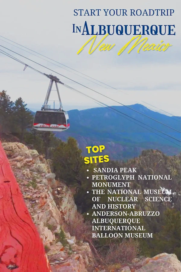
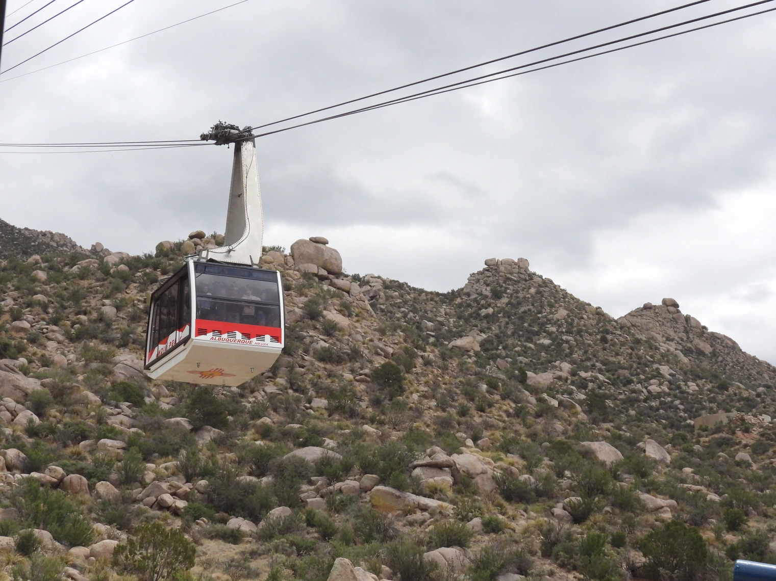
The city is framed by the majestic Sandia Mountains, which glow a brilliant pink at sunset—a phenomenon that inspired their name, derived from the Spanish word for "watermelon." Outdoor enthusiasts can explore the Sandia Peak Tramway, one of the longest aerial tramways in the world, offering panoramic views of the Rio Grande Valley.
Planning a Ski Trip?
While Albuquerque itself doesn’t offer full-scale ski resorts, you're just 45 minutes from Sandia Peak Ski Area. For more variety, head north to Ski Santa Fe or Taos Ski Valley, both popular winter destinations within a 2–3 hour drive.Albuquerque blends historic adobe plazas, Route 66 neon, and easy access to outdoor scenery. Spend a morning wandering Old Town (museums, galleries, courtyard cafés), ride the Sandia Peak Tramway for big-sky views, and catch sunset over the Rio Grande. It’s an easy base for day trips—Petroglyph National Monument sits on the city’s edge, and Santa Fe is a straight shot up I-25.
Related reads: See our pages for; Old Town, Sandia Peak Tramway, and Petroglyph National Monument.
Albuquerque lies in the Rio Grande Valley and is surrounded by arid desert and highlands. The Rio Grande river flows through the middle of the Rio Grande Valley. The Rio Grande river is one of the longest rivers in North America, stretching from Colorado through New Mexico and down to the Gulf of Mexico.. The valley is characterized by its green belt of cottonwood trees and marshlands that have supported human habitation for thousands of years. Just to the east of Albuquerque are the Sandia Mountains which majestically rise up from the valley floor creating a wonderful backdrop for the city.
What is the elevation of Albuquerque? The elevation of Albuquerque varies due to its location in the Rio Grande Valley and the surrounding foothills, but the city's average elevation is about 5,312 feet (1,619 meters) above sea level. The lowest point is around 4,900 feet (1,494 meters) near the Rio Grande, while areas in the foothills to the east can reach 6,700 feet (2,042 meters). The nearby Sandia Mountains rise dramatically, with Sandia Peak reaching an elevation of 10,678 feet (3,255 meters).
Albuquerque's elevation, high desert landscape, and towering mountain peaks reminded us of Denver — though it's far less crowded.
How big is Albuquerque? Albuquerque spans approximately 189 square miles (490 square kilometers). Its population is around 560,000 as of recent estimates, making it the largest city in New Mexico.

If you enjoy our videos click here to subscribe to our Youtube Channel.

Click the above video poster image to join us as we explore Albuquerque New Mexico's Top Sites! In this video, we’ll provide an informative introduction to the city and its history along with Top Sites you won’t want to miss, including the stunning Sandia Mountains, the fascinating Petroglyph National Monument, and the interactive exhibits at The Science Museum. We'll also give you an insider’s look at the world-famous Albuquerque International Balloon Fiesta—an event that fills the skies with colorful hot air balloons every October. Whether you're planning a visit or simply curious about this enchanting city along the Rio Grande River, we've got you covered with essential tips and intriguing stories.
Pre-Colonial Era
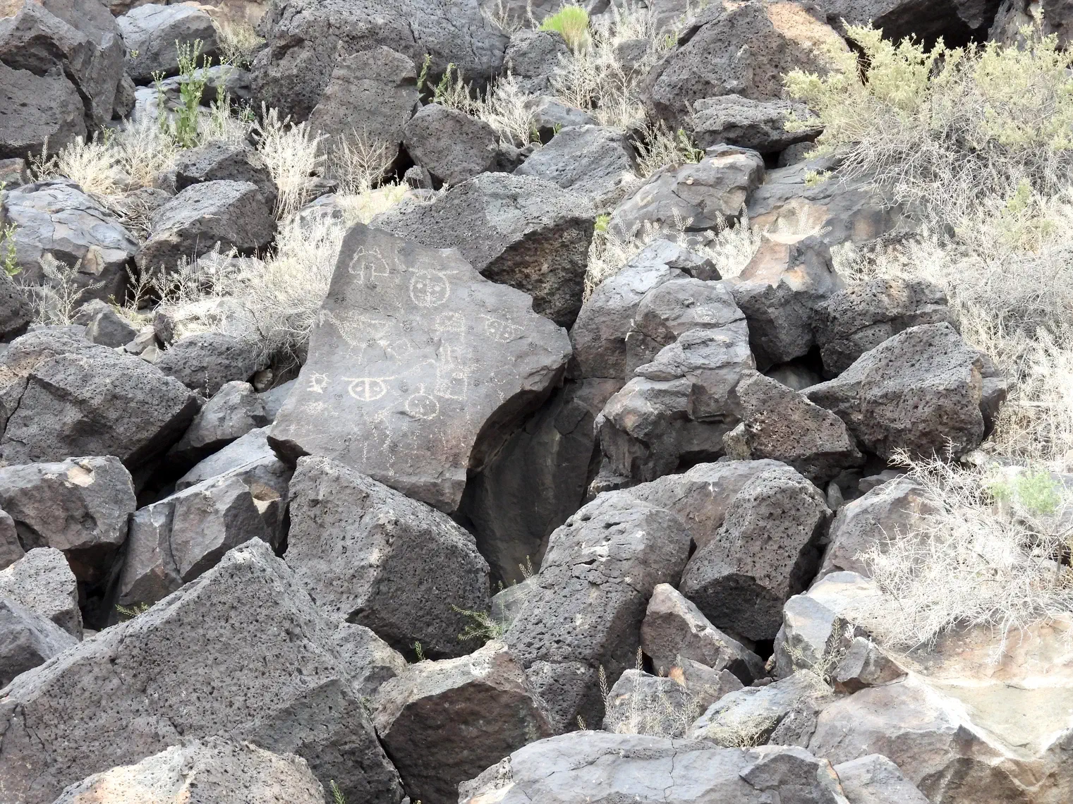
Long before European settlers arrived, the Albuquerque area was inhabited by Native American groups, particularly the Ancestral Puebloans. Evidence of these early civilizations can still be seen today in the form of ancient rock art at the Petroglyph National Monument and in nearby pueblos. For centuries, the Rio Grande Valley supported farming communities due to its fertile soil and access to water.
Spanish Colonization (1598-1700)
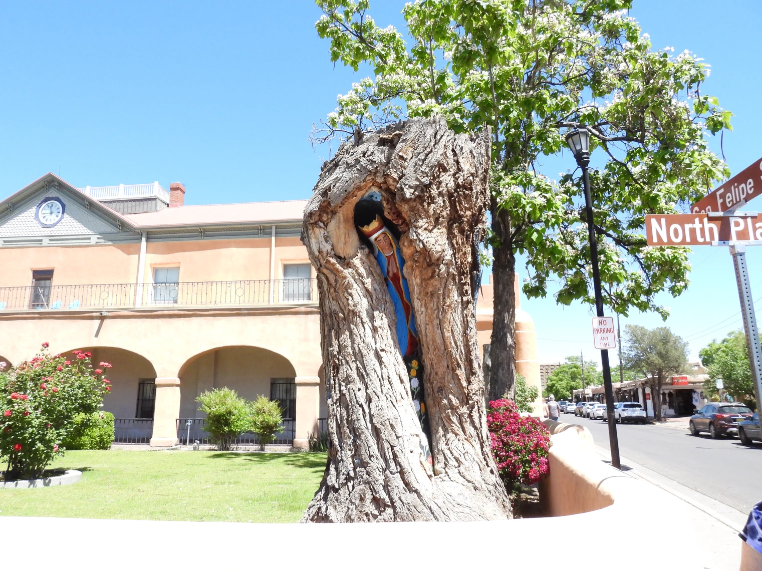
Albuquerque was founded in 1706 as part of New Spain. It was established as a villa, or town, by Spanish settlers who named it after the Viceroy of New Spain, Francisco Fernández de la Cueva, the Duke of Alburquerque (the extra 'r' was later dropped). The Spanish built Old Town, centered around a plaza, following the traditional Spanish colonial model. The San Felipe de Neri Church, built in 1793, is one of the city’s oldest surviving structures and remains a prominent landmark in Old Town.
In 1680 the Pueblo Revolt forced the Europeans to leave New Mexico until 1692, when the Spanish reoccupied the middle Rio Grande Valley. The Pueblo Revolt is considered to be the only successful indigenous revolt in North American history. Led by a Tewa Tribe leader named Po’pay, the Pueblo peoples of present-day New Mexico successfully expelled the Spanish colonizers, who had imposed their rule, religion, and culture on the indigenous population since the late 1500s.
Mexican and Territorial Period (1821-1912)
In 1821, Mexico gained independence from Spain, and Albuquerque became part of the new Mexican Republic. However, this period was short-lived. After the Mexican-American War, the Treaty of Guadalupe Hidalgo in 1848 ceded New Mexico to the United States, making Albuquerque part of American territory.
During this period, Albuquerque began to develop as a frontier town. In 1880, the Atchison, Topeka, and Santa Fe Railway arrived, transforming the city from a small settlement into a key hub for trade and commerce. This ushered in what is known as "New Town" Albuquerque, located near the railroad tracks, while Old Town retained its historical and cultural significance.
Statehood and 20th Century Growth (1912-2000s)
New Mexico became a U.S. state in 1912. Albuquerque’s growth accelerated in the early 20th century due to its strategic location along Route 66, the iconic highway that connected Chicago to Los Angeles. The route brought travelers, businesses, and motels to the area, helping the city thrive.
The city’s landscape and climate made it a desirable location for military and scientific research, leading to the establishment of Kirtland Air Force Base and Sandia National Laboratories during and after World War II. Albuquerque became a center for nuclear research during the Manhattan Project.
Modern Albuquerque
Today, Albuquerque is known for its cultural diversity, with a strong presence of Native American, Hispanic, and Anglo influences. The city has expanded significantly in the 21st century, becoming a hub for technology, aerospace, and renewable energy industries. It also continues to celebrate its heritage through events like the annual International Balloon Fiesta, and landmarks like the Indian Pueblo Cultural Center.
Albuquerque’s airport can occasionally experience strong winds, especially during certain times of the year, due to Albuquerque's location near the Sandia Mountains. It can get windy here as the wind crests the mountains and then flows down to the valley floor which can make for a bumpy ride.
Our flight to Albuquerque was quite a ride, with some intense turbulence as we neared landing. On a United Airlines flight from Richmond via Houston, we switched to a United Express Embraer 175LR aircraft. During our landing approach, the wind conditions were challenging, causing the pilot to abort the landing because a tailwind of about 30 knots came up when we were just 800 ft above ground. The landing speed is very important to avoid disaster, and the additional 30 knots of tail-wind speed was over the landing speed limit for that aircraft
The pilot initiated a "go-around" and we went up and to the west of Albuquerque and came back to land the plane from that direction. He was able to land it the second time, thank goodness, but it was one of the bumpiest flights we’ve ever had. It took a few hours for our stomachs to settle back down.
NOTE: Where appropriate, a destination in the following list will be linked to our content (or their website) on this page;
Yes, Albuquerque is the largest city in New Mexico in terms of both population and land area. It has a population of approximately 560,000 residents, with nearly one million people in the greater metropolitan area. It is significantly larger than Santa Fe, the state capital, and Las Cruces, the second-largest city.
Albuquerque has a high desert climate with over 310 sunny days per year. Winters are mild with occasional snow, while summers are hot but dry, with monsoon storms in July and August. Spring is windy, and fall is pleasant, making it the best time to visit, especially for the Balloon Fiesta. The city gets about 9 inches of rain annually, and its 5,312-foot elevation means thinner air and stronger sun.
Albuquerque spans 187 square miles at elevations ranging from 4,500 to 6,500 feet above sea level.
The Sandia Mountains on the city’s east side rise to more than 10,600 feet in elevation and turn a watermelon pink color at sunset (“Sandia” is Spanish for “watermelon;”).
Yes, Albuquerque has more than a dozen museums, an Old Town area featuring more than 150 shops, restaurants and galleries, and a nostalgic stretch of Route 66 that combines old and new for an exciting visitor experience.
Albuquerque was founded in 1706, making it over 318 years old as of 2024. It was established as La Villa de Alburquerque by Spanish settlers and named after the Duke of Alburquerque in Spain. The extra "r" in the original name was later dropped. However, the area has been inhabited for thousands of years by Native American peoples, including the Puebloan cultures along the Rio Grande.
Every October Albuquerque is host to the world class Albuquerque International Balloon Fiesta in which over 800 hot air balloons participate. See the "Visit Albuquerque Site" for more information, schedule, etc.
Albuquerque's Park Management Division maintains and manages more than 288 park sites. These parks contribute to the city's extensive parkland, which covers approximately 18% of Albuquerque's total area.
Since the local soil makes it tough to support high-rise buildings, Albuquerque’s tallest building is only 351 feet high with 22 stories. The tallest building in Albuquerque is the Albuquerque Plaza, which stands at 351 feet (107 meters) tall with 22 floors. It was completed in 1990 and is a mixed-use skyscraper, housing office space and the Hyatt Regency Albuquerque hotel. It remains the tallest building in New Mexico as well.
Google Maps says that Santa Fe is 63.1 miles from Albuquerque via I-25.
As of July 1, 2023, the estimated population of Albuquerque, New Mexico, is 560,274. The Albuquerque metropolitan area, which includes surrounding communities, had an estimated population of 955,000 in 2023.
Albuquerque's high elevation (over 5,000 ft) can affect visitors in a number of ways. It can take a couple of days to adjust, and visitors may feel tired more easily during physical activity. The air is thinner, so it's important to drink plenty of water to avoid dehydration and altitude sickness. With it's elevation of 5,300 ft. you will need to stay hydrated, take it easy the first day, use sun protection, and wear layers.
At over 5,000 feet (1,500 meters) above sea level, Albuquerque’s high altitude affects baking (bread rises faster) and sports performance (athletes train here to improve endurance).
The hit TV show Breaking Bad was filmed in and around Albuquerque, drawing tourists eager to see filming locations like Walter White’s house, Saul Goodman’s office, and Los Pollos Hermanos (Twisters restaurant).
Albuquerque has been a prominent filming location for numerous movies and TV shows over the years. The city has hosted a significant number of productions, contributing to New Mexico's reputation as a premier production hub. Click here to view a complete IMDB list of movies and TV shows that have been filmed in Albuquerque (you will be surprised at the number!).
Believe it or not, Albuquerque offers quick access to snowy slopes! The Sandia Peak Ski Area sits just east of the city and is accessible via the scenic Sandia Crest Byway or the Sandia Peak Tramway (winter permitting). For those willing to drive a bit farther, Ski Santa Fe and Taos Ski Valley offer full-service resorts with diverse terrain and alpine ambiance. Click here to view a Google Map for "snow skiing areas near Albuquerque".
Not strictly—Old Town and downtown are doable with rideshare. A car makes Sandia Peak, Petroglyph, and other day trips easier.
Yes for views—time it for golden hour if skies are clear. Bring a layer; it’s cooler and breezier at the top. When we visited Sandia Peak in May, the temperature at the top was in the low 30's farenheit and the wind was blowing strongly. You need to dress appropriately!
Is Albuquerque Considered to be ADA Accessible?
Yes, Albuquerque is generally considered an accessible city, with a flat terrain, ample curb cuts, and an ADA-compliant bus system (ABQ Ride). The city actively promotes accessible tourism and provides resources like Destination Accessibility for wheelchair and scooter rentals. However, accessibility can vary across the city, as the ADA's requirements and compliance levels differ for various entities, and some public transportation resources, such as the Sunvan system, have a complex approval process and limited availability.
City overview: Core areas like Old Town and the Museum District have curb ramps and generally good sidewalk coverage, though historic surfaces can be uneven in spots. Crosswalk timing and shade vary—plan extra time in summer heat.
Old Town: Compact and mostly level; some brick/adobe surfaces are bumpy. Many shops and museums have step-free entries; a few older doorways are narrow. Restrooms are available near the plaza.
Sandia Peak Tramway: The base area is straightforward; boarding assistance is typically available. It’s cooler and windier at the top. Trails near the summit are natural surface (uneven/rocky) and may not be suitable for wheelchairs or strollers—confirm details on the official accessibility page before you go. Click here to go to the official Sandia Peak website.
Petroglyph National Monument: The Visitor Center is accessible; trail accessibility varies widely (sand/rock). Choose the easiest loops if mobility is limited and check the official trail accessibility notes in advance.
Parking: Signed accessible spaces exist around Old Town, museums, and the tram base. Event days (e.g., Balloon Fiesta) reduce availability—arrive early.
Mobility aids & strollers: Great on paved paths and plazas; sandy/rocky trails are challenging without wide tires.
Service animals: Permitted wherever the public can go (follow site-specific rules). Summer pavement can be very hot—plan paw protection/water.
Altitude & Weather: ~5,300 ft / 1,615 m. To avoid altitude sickness, it is important to stay hydrated, use sun protection, and pace activities on day one.
Albuquerque ADA Accessibility Links
 Sandia Peak Tramway
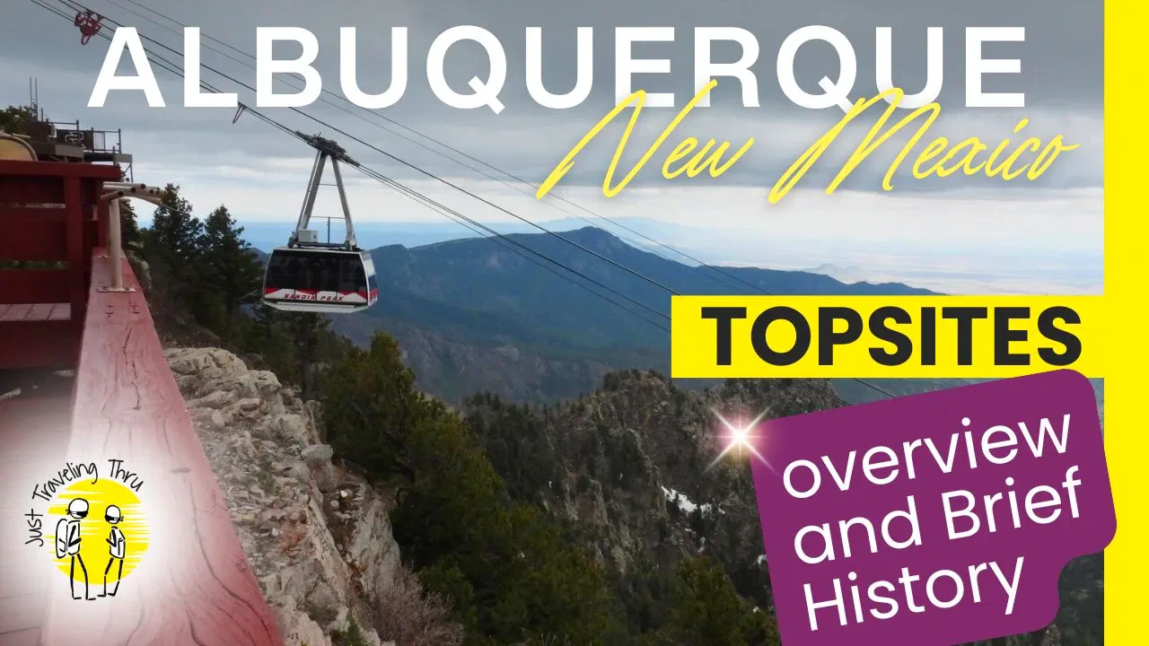
Sandia Peak is one of the top things to do in Albuquerque since it opened to the public on May 7, 1966. It is located in the Sandia Mountains, just east of Albuquerque, New Mexico. The peak rises to an elevation of 10,378 feet (3,163 meters) and is part of the Cibola National Forest. The Sandia Peak Aerial Tramway is 2.7 miles long and provides access from the base near Albuquerque to the summit in about 15 minutes. It is a popular destination for both locals and visitors. In fact, it attracts approximately 200,000 to 300,000 visitors each year.
This is a great way to view the Albuquerque area from a height, come on over to our Sandia Peak Page and we'll show you more of this really cool tramway.
 Petroglyph National Monument
Petroglyph National Monument in Albuquerque, New Mexico, is a fascinating destination that offers a unique glimpse into the ancient past. Spanning over 7,200 acres, it protects one of the largest collections of petroglyphs in North America, with over 24,000 images carved into volcanic rock by Native Americans and early Spanish settlers. These petroglyphs, some of which are more than 700 years old, provide insight into the cultural and spiritual lives of the people who created them.
The monument offers several hiking trails that wind through the desert landscape, allowing visitors to explore the petroglyphs up close while enjoying scenic views of Albuquerque and the surrounding mountains. The hikes vary in difficulty, making it accessible to all ages and fitness levels. Interpretive signs along the trails help visitors understand the significance of the rock art and the history of the area.
In addition to its historical significance, Petroglyph National Monument is a great place for nature lovers, with opportunities to see desert wildlife and native plants. It’s a peaceful escape from the city, offering a blend of cultural history, outdoor recreation, and natural beauty that makes it a rewarding place to visit for history buffs, hikers, and families alike.
This Monument is like walking into history, come on over to our Petroglyph National Monument Page and we'll show you more of what we explored.
 Old Town Albuquerque
Old Town Albuquerque is a historic district located in the heart of Albuquerque, New Mexico. Founded in 1706 by Spanish settlers, it retains much of its colonial charm and is known for its adobe-style architecture and narrow streets. At the center of Old Town is the iconic San Felipe de Neri Church, the oldest surviving building in the city, surrounded by a picturesque plaza that serves as the social and cultural hub.
Visitors can explore a variety of local shops, art galleries, and museums that showcase Southwestern art, Native American crafts, and New Mexican culture. Popular spots include the Albuquerque Museum, Explora Science Center, and The New Mexico Museum of Natural History and Science. The area also features restaurants offering authentic New Mexican cuisine, including green chile specialties. Old Town also hosts regular cultural events, live music, and seasonal festivals, making it a lively destination for both tourists and locals.
This is an interesting area of Albuquerque, come on over to our Old Town Page and we'll show you more of what you can see there.
This outing was because I have been a life-long aviation & military enthusiast. My father was a career Air Force - so I spent all of my early years growing up on Air Force Bases all over the world, and then I spent four years in the Navy. When we first did our trip research and I saw how close this museum was to our hotel, we decided that we would visit and explore this facility.
The National Museum of Nuclear Science & History in Albuquerque ignites curiosity. Inside, exhibits chart the atomic age, from the Manhattan Project's urgency to Cold War tensions. You'll see replicas of Fat Man, the bomb dropped on Nagasaki, and feel the weight of history. Yet, the museum isn't just about war. Interactive displays showcase nuclear medicine's life-saving applications and futuristic energy solutions. Explore "Little Albert's Lab," a playful space for kids to learn about radiation. Stepping outside, Heritage Park displays colossal artifacts like a B-52 bomber, a stark reminder of nuclear power's potential for both destruction and progress.
Beyond its historical significance, the museum showcases the peaceful uses of nuclear energy. From medicine to power generation, visitors gain a deeper understanding of how this powerful force benefits society. The museum also addresses the challenges and ethical considerations surrounding nuclear technology, promoting informed dialogue and critical thinking.
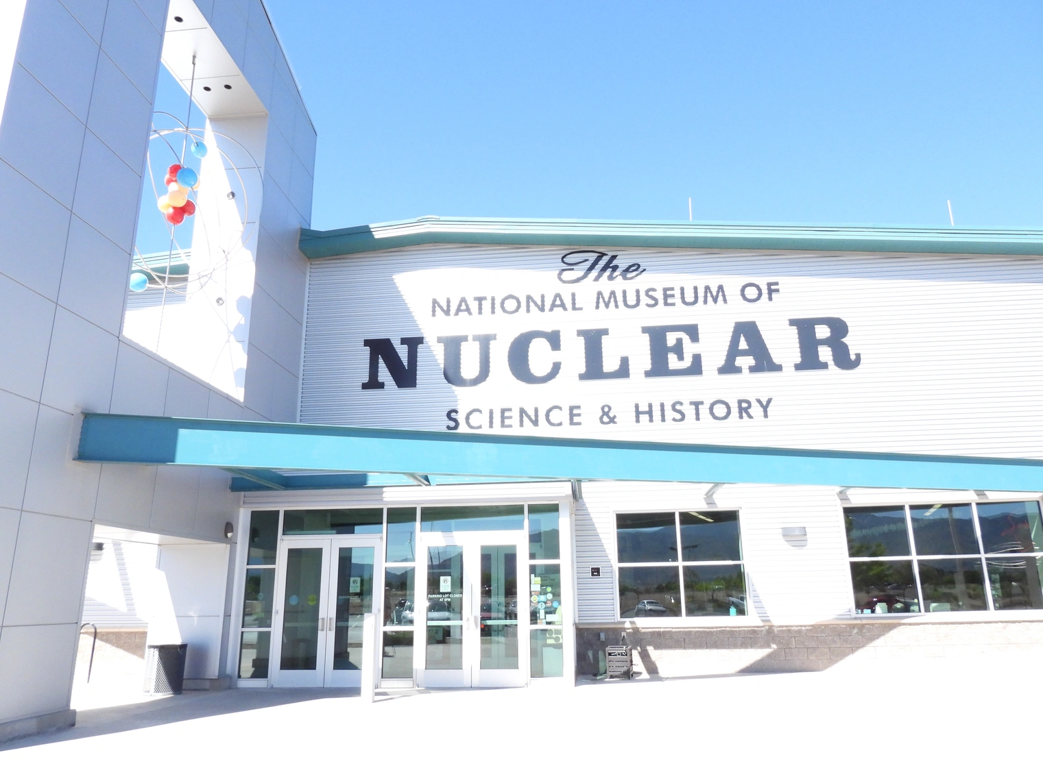 Museum Entrance
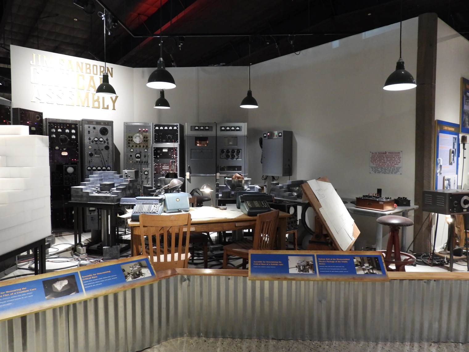 Atomic Weapons Area
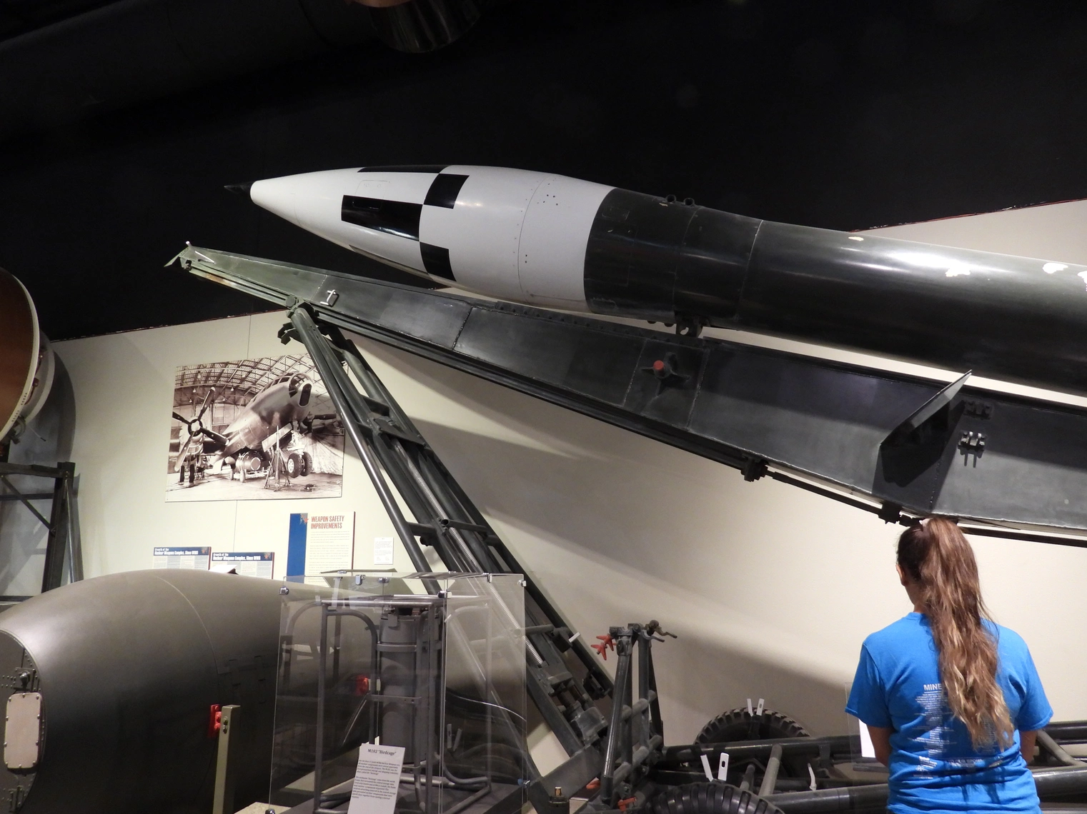 Missile Delivery Systems
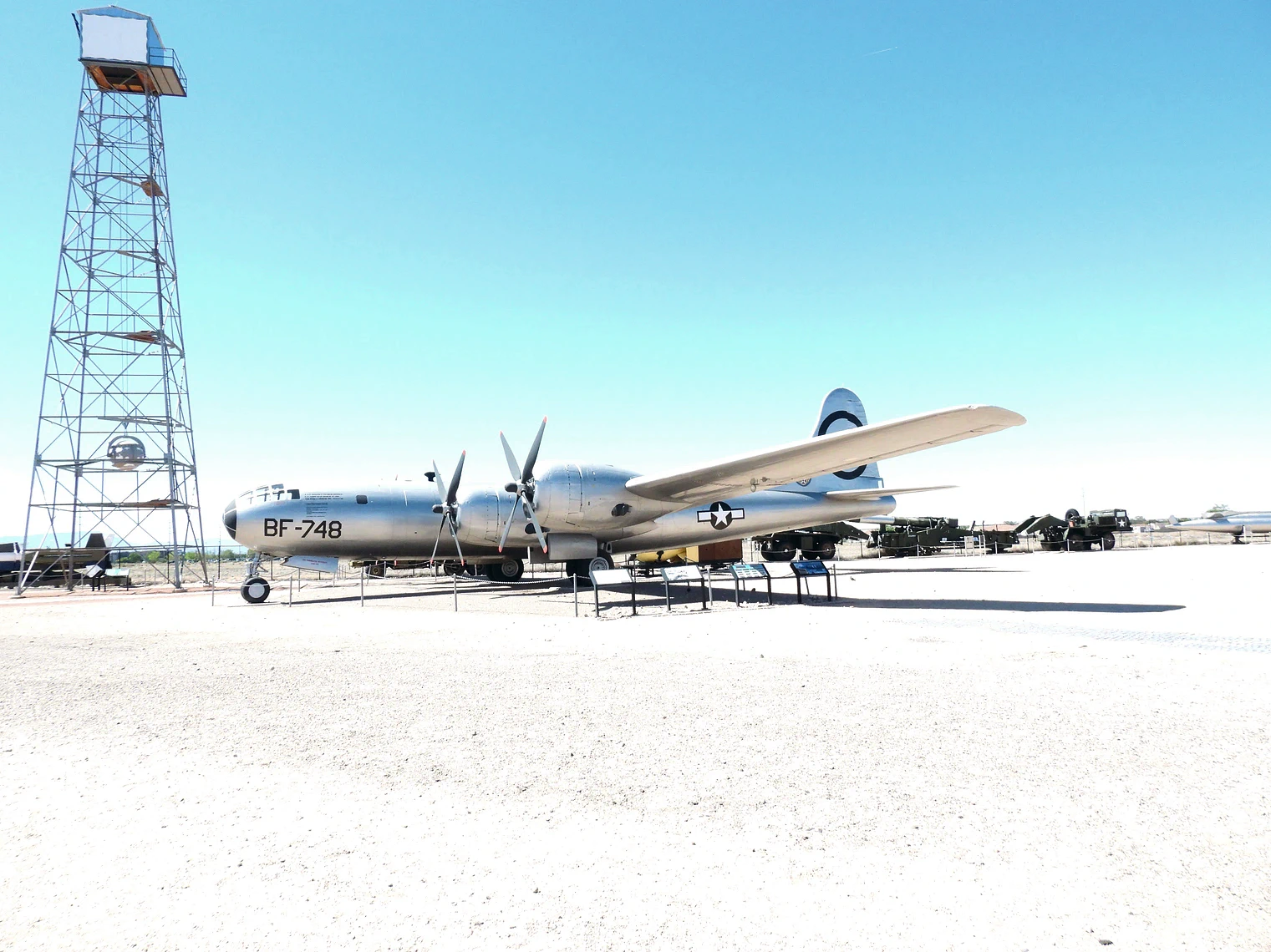 B-29 Super Fortress
Best time to go: Spring and fall for mild temps. Summer is hot/dry (start early); winter is quieter and can be crisp with clear light. Balloon Fiesta (early October) is spectacular but books up far in advance—plan lodging early if visiting then.
Getting there & getting around
Where to Stay
Parking & Transport
Weather, Altitude & Tips
Maps & Other Useful Information
In the trip menu list below, a "dark filled circle" represents a destination where we stayed, and the "dark filled arrow" items below that circle location, represent the destinations we visited while in that city or location. A circle icon that is not filled represents a city that we visited or stayed in, but did not necessarily explore.
Click any link below to go directly to that page;
Chaco Culture National Historical Park, NM
Grand Canyon, AZ
Note: All images featured on this page are the exclusive property of Just Traveling Thru, LLC, unless otherwise stated. When images from external sources are used, full credit is given to the original creator, along with a link to the specified license or usage terms. We are committed to respecting copyright and intellectual property rights, ensuring that all third-party images are properly attributed. If you have any questions regarding image ownership or usage rights, please feel free to contact us.
Affiliate Links: We may earn a commission if you make a purchase through one of our affiliate links. This helps support our travel content — thank you!
Content: To review any of our content, make suggestions and/or comments, please click the "About" menu link at the top of this page. You will find our "Contact Us" link on that drop-down menu.

