
by Celeste Lipford and Terry Lipford - last updated on 9/22/2024
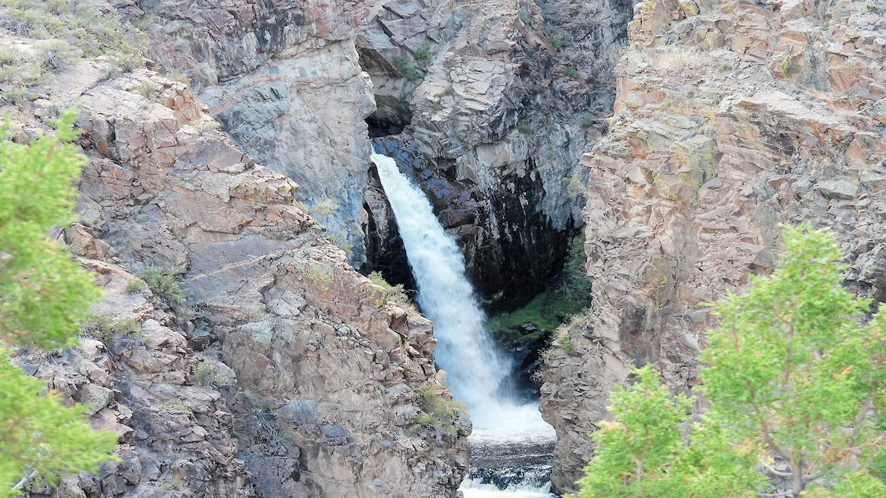
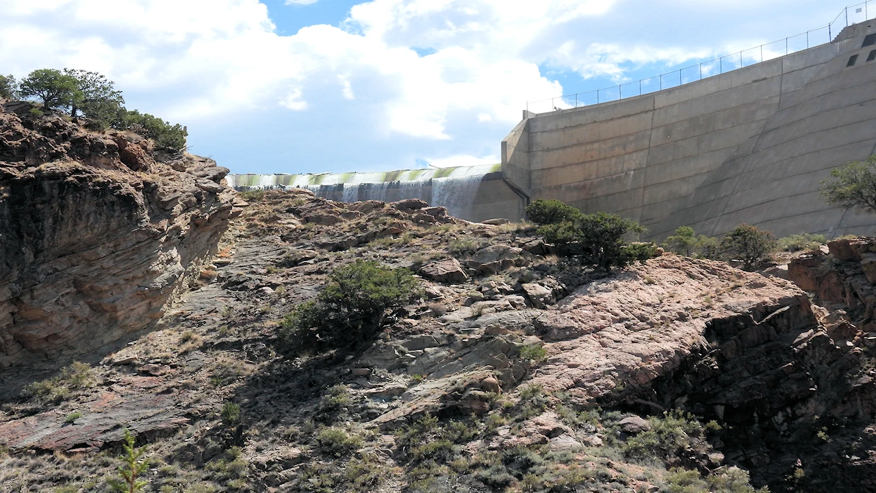
Nambe Falls is a picturesque waterfall located just 16 miles north of Santa Fe, New Mexico located in the Sangre de Cristo Mountains. The waterfall is about 120 ft tall and cascades gracefully over rugged cliffs.
The Nambe Pueblo is one of the six Tewa-speaking Pueblos located in northern New Mexico. Nambe Falls is considered a sacred site by the Nambe Pueblo. It is part of the traditional lands that hold spiritual and cultural importance for the community. The Nambe Pueblo people have historically used the area around the falls for ceremonial purposes and as a natural resource. The Nambe Pueblo manages and protects Nambe Falls to preserve its natural beauty and cultural significance. They oversee visitor access and conservation efforts to ensure that the site remains a respected and cherished part of their heritage
We visited during our stay in Santa Fe while doing a roadtrip in New Mexico and Arizona. It was fun to get out of town and take a hike off of the beaten path.
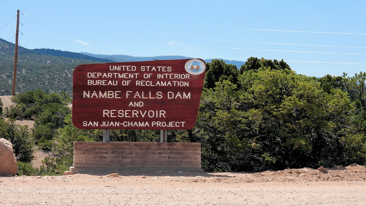
WARNING: The per-carload entrance fee is $20 in cash only. If you plan to fish, the fee is $18 per person with a 5 fish bag limit. You should visit the Nambe Recreation Area Website for more information.
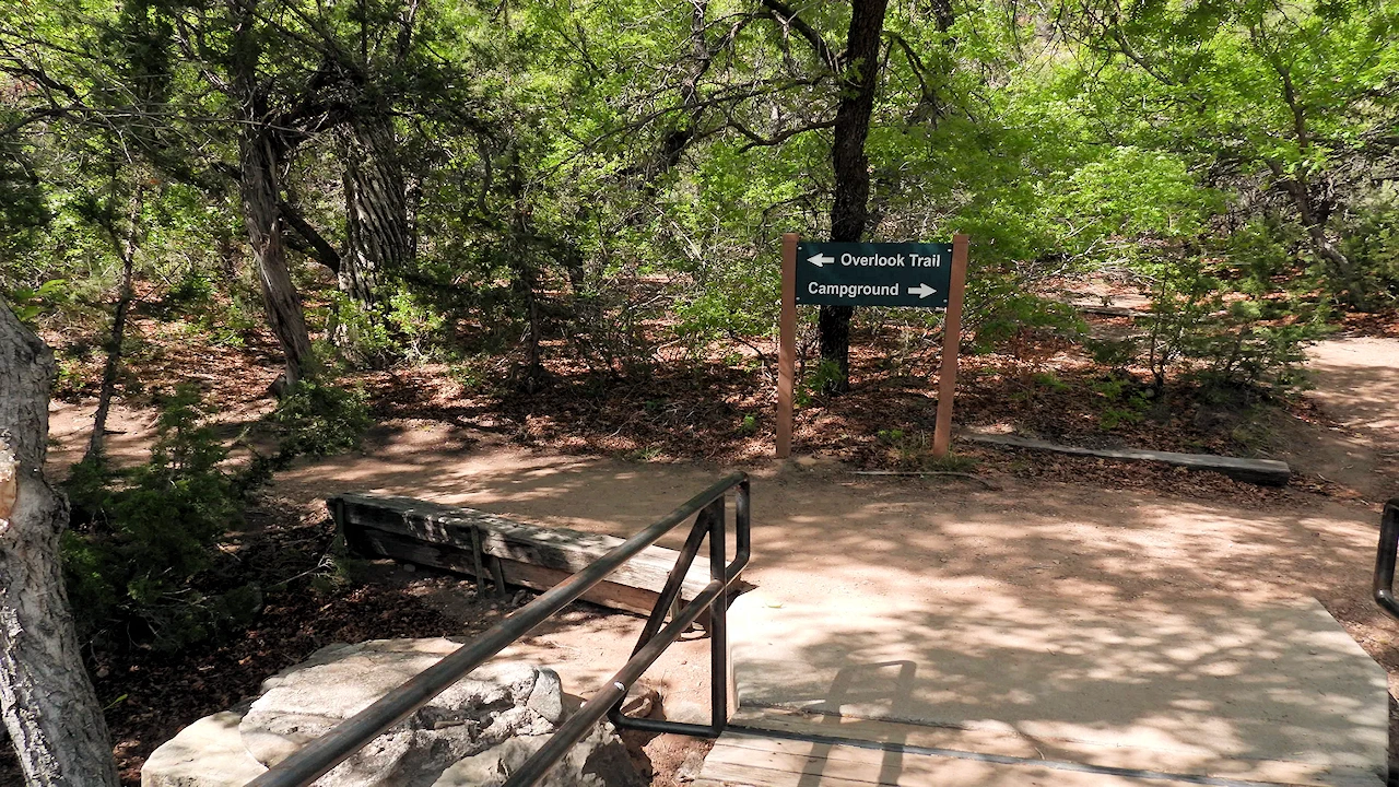
There are two distinct hiking trails leading to different perspectives of the falls, visitors can choose to experience the powerful rush from the bottom or enjoy a panoramic view from the top.
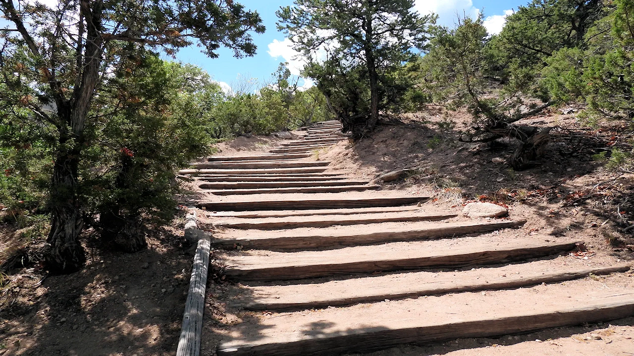
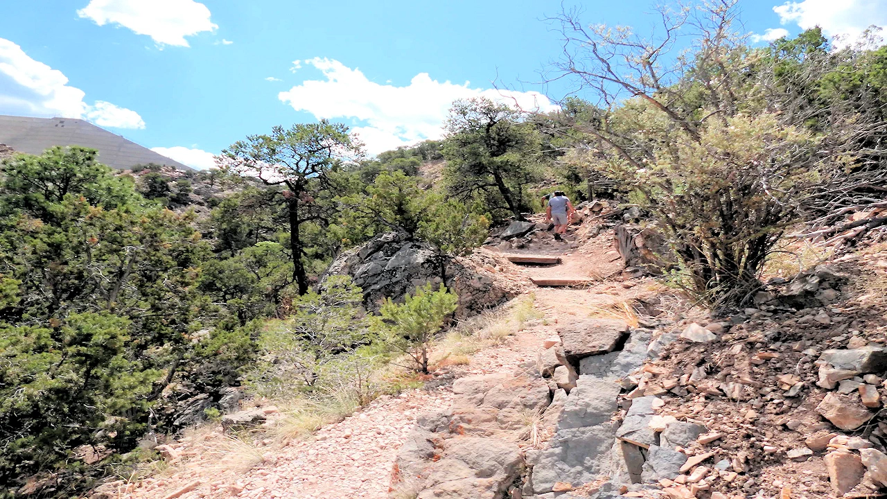
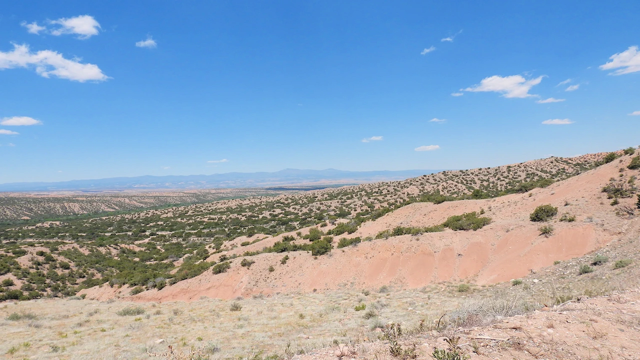
Upper Falls Trail: The hike to the top of Nambe Falls is about 1.5 miles (2.4 kilometers) round-trip. The elevation change is approximately 800 feet (244 meters) from the trailhead to the top of the falls. The trail can be steep and rugged, so it’s recommended for those with a moderate level of fitness and hiking experience. Take it slow and you will be fine. It’s not ideal for those with a fear of heights.
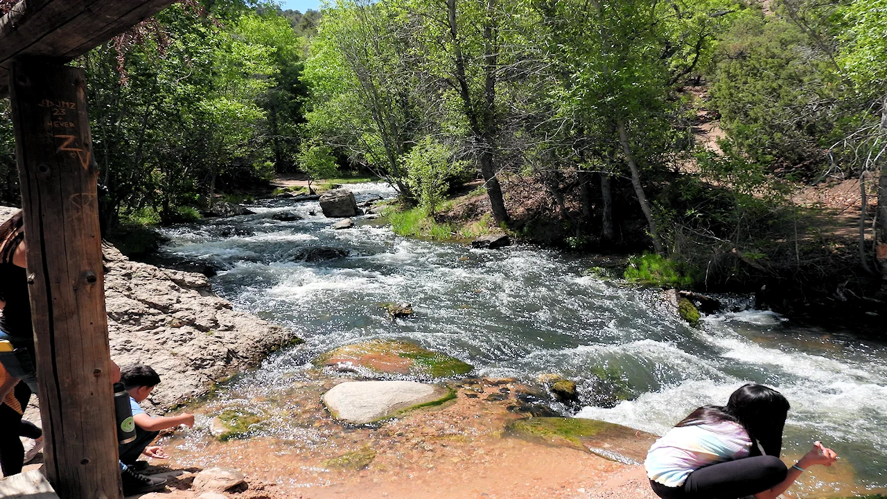
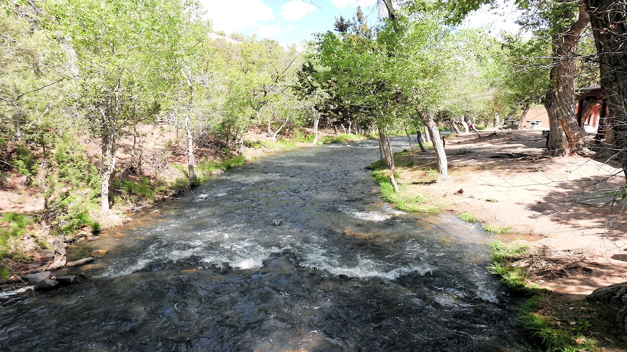
Lower Falls Trail: The trail to the bottom of Nambe Falls is about 0.75 miles (1.2 kilometers) round-trip. This trail provides a closer view of the falls and is generally considered easier than the hike to the top, though it can still be somewhat challenging due to the terrain. When we visited in May the water was high and there were spots where you had to wade in the water which was rushing pretty quickly or climb over rocks to avoid the water. We weren’t able to complete the lower trail due to this but many young people and families plotted their path and tackled the challenge.
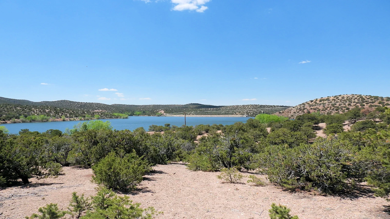
As you can see above in image # 6, the 56 acre Nambe Recreation Lake sits behind the dam and is stocked with rainbow and cutthroat trout and seems to be a popular fishing spot as we saw a lot of people there fishing. After we finished our hike up to the dam, we drove up to the lake area and explored for a few minutes. There were quite a few people fishing, but there is a number of good places to park.
Nambe Lake is located a short distance from Nambe Falls and is part of the Nambe Pueblo lands. It lies in a scenic area surrounded by the rugged terrain of the Sangre de Cristo Mountains. It is an artificial lake created by the Nambe Falls Dam and is fed by the Rio Nambe.
Recreational Activities at Nambe Falls Reservoir:
Nambe Lake is stocked with various fish species, including trout, making it a popular spot for fishing enthusiasts.
Non-motorized boats are allowed on the lake, providing opportunities for peaceful paddling and scenic views.
The area around the lake features picnic areas and trails, allowing visitors to enjoy the natural beauty of the surrounding area.
Two short trails lead to different viewpoints—one to the overlook and one along the river to the base. Expect gorgeous views and (on the lower route) wet feet.
Thursday through Monday from 7:00 AM to 7:00 PM. Check their website for more info, other information and/or changes in hours.
It costs $20 per day per car and they only accept CASH!. They have other fees for fishing and renting watercraft, etc when visiting the lake area. Check their website for up to date rates.
Address: Nambe Falls Recreation Area, County Road 114, Santa Fe, NM 87506
Coordinates: Approximately 35.8943° N latitude and 105.9276° W longitude
How far is Nambe Falls from Santa Fe: About 16 miles north, roughly a 30-minute drive
How far is Nambe Falls from Espanola: About 12 miles southeast, roughly a 20-minute drive
How far is Nambe Falls from Taos: About 60 miles southwest, roughly a 1.5-hour drive
How far is Nambe Falls from Albuquerque: Nambe is about 89 miles northwest, roughly a 1.5-hour drive
The Ranger Station has water, soda, snacks and ice for sale, there is nothing else, so you should bring your own water and food.
Spring (March to May): Spring is a wonderful time to visit as the weather is generally mild, and the waterfalls are often at their fullest due to snowmelt. Wildflowers begin to bloom, adding vibrant colors to the landscape. However, some trails may still be muddy from melting snow, so be prepared for potentially wet conditions.
Summer (June to August): Summer offers warmer temperatures and longer daylight hours, making it ideal for hiking and exploring. The trails are usually dry and accessible. This is the peak tourist season, so you might encounter more visitors. Also, temperatures can be quite warm, especially in lower elevations.
Fall (September to November): Fall provides cooler temperatures and stunning autumn foliage, enhancing the scenic beauty of the area. The trails are less crowded compared to summer.
Yes, swimming is allowed at Nambé Falls & Lake Recreation Area, which offers both a waterfall and swimming opportunities. While swimming is permitted, be prepared for a potentially mucky lake bottom and limited places to get in and out of the water, though some swimmers find the temperature enjoyable.
Park in the parking lot and walk up the trail to the top where the views are very good. This trail is 0.5 mi long with an elevation gain of 144 ft. Check their website for information regarding what trails are open or closed..
There are two main trails: one leading to the top of the falls for panoramic views, and another to the base for close-up waterfall access. Here is a link to the All Trails Website where you will find detailed hiking info, maps, hints, tips and other useful information for hiking Nambe Falls.
Yes. Nambe Falls is located on Nambe Pueblo land, and visitors must pay a small entrance fee that supports the Pueblo community.
You can spend anywhere from 30 minutes to a full day at Nambé Falls, depending on your interests. A quick visit to see the falls from the bottom takes about 30 minutes. If you want to explore both the river trail and the hill trail for different views, plan for about 1-2 hours. For a more immersive experience, including hiking more challenging trails, a picnic, or fishing, a half-day to full-day visit is recommended.
Yes if you take the Lower Falls Trail to reach the lower falls area you’ll likely cross the stream; waterproof sandals help. When we were there in May, the water level was high and some hikers did not attempt to cross.
Yes, they offer day sites for picnics, basic sites, hookup sites and ramada rentals. See their website for current information and pricing.
Operations and fees vary by season. Check current hours/closures at the entrance or official sources before you go.Yes, they offer day sites for picnics, basic sites, hookup sites and ramada rentals. See their website for current information and pricing.
Upper trail to the overlook and lower trail along/through the river (short but can be slippery). Take your time and mind footing.
Water shoes or sturdy sandals help on the lower trail. Protect phones/cameras in a small dry bag if you plan to wade. Yes to water, the only water you will have on the trail is the water you brought. The river water at Nambé Falls is not safe to drink directly. While the area is mountainous and fed by snowmelt, the water can contain pathogens or contaminants from human or animal activities and should be treated (filtered or boiled) before drinking.
Yes, High-desert sun is strong—hat, sunscreen, and water are musts. In summer, watch monsoon forecasts for storms/flash-flow.
Nambe Falls is within Nambé Pueblo. Follow posted rules, stay on designated paths, and be mindful of cultural sensitivity.
Parking is located close to the recreation area; arrive earlier on busy weekends. Facilities may be limited—plan accordingly. Parking at Nambé Falls is good, with specific areas available for vehicles and horse trailers at the Nambé Falls & Lake Recreation Area, managed by the Pueblo of Nambé. You must pay a cash-only entrance fee to access the area, which provides parking for a day trip or longer stays for camping. See the Google Map link:
Yes, leashed pets are allowed on the Nambé Falls trails, according to the AllTrails website. However, it is always best to confirm the pet policies directly with the Nambé Falls & Lake Recreation Area or the managing authority before your visit to ensure your pet can enjoy their trip with you. You are required to cleanup after your pet, so bring your own waste bags.
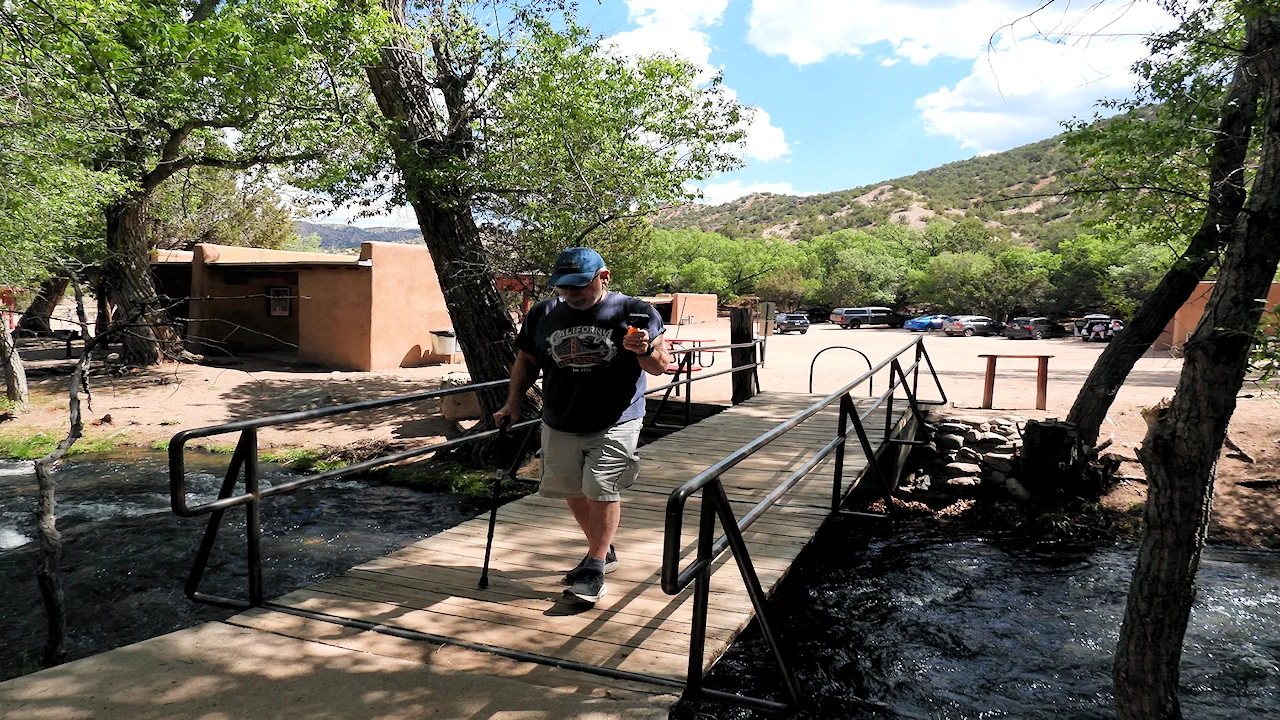
Nambé Falls is not fully wheelchair accessible; the Overlook Trail is steep and the River Trail involves water crossings, making neither suitable for wheelchairs or strollers. The area is generally open Thursday to Sunday, with two short trails from the parking lot, but the specific accessibility depends on the visitor's mobility. I hiked up the Overlook Trail when we were there and I use a cane and I had no problems with the trail.
Plan Your Visit to Nambe Falls Travel Resources — Maps, Parking, Passes & Links
Nambé Falls Travel Resources — Maps, Parking & Passes
Quick, reliable links to plan your trip.


In the trip menu list below, a "dark filled circle" represents a destination where we stayed, and the "dark filled arrow" items below that circle location, represent the destinations we visited while in that city or location. A circle icon that is not filled represents a city that we visited or stayed in, but did not necessarily explore.
Click any link below to go directly to that page;
Chaco Culture National Historical Park, NM
Grand Canyon, AZ
Note: All images featured on this page are the exclusive property of Just Traveling Thru, LLC, unless otherwise stated. When images from external sources are used, full credit is given to the original creator, along with a link to the specified license or usage terms. We are committed to respecting copyright and intellectual property rights, ensuring that all third-party images are properly attributed. If you have any questions regarding image ownership or usage rights, please feel free to contact us.
Affiliate Links: We may earn a commission if you make a purchase through one of our affiliate links. This helps support our travel content — thank you!
Content: To review any of our content, make suggestions and/or comments, please click the "About" menu link at the top of this page. You will find our "Contact Us" link on that drop-down menu.