Visit Sandia Peak Tramway in Albuquerque
Thrilling Tramway Ride with Breathtaking Views
by Celeste Lipford and Terry Lipford - last updated on 12/23/2024
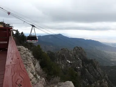
Sandia Peak is one of the top things to do in Albuquerque since it opened to the public on May 7, 1966. It is located in the Sandia Mountains, just east of Albuquerque, New Mexico. The peak rises to an elevation of 10,378 feet (3,163 meters) and is part of the Cibola National Forest. The Sandia Peak Aerial Tramway is 2.7 miles long and provides access from the base near Albuquerque to the summit in about 15 minutes. It is a popular destination for both locals and visitors. In fact, it attracts approximately 200,000 to 300,000 visitors each year.
We love a good tram ride and have been on trams all over Europe and several in the United States, including the Cannon Mountain Aerial Tramway in the White Mountains of New Hampshire (Click here to view that page).
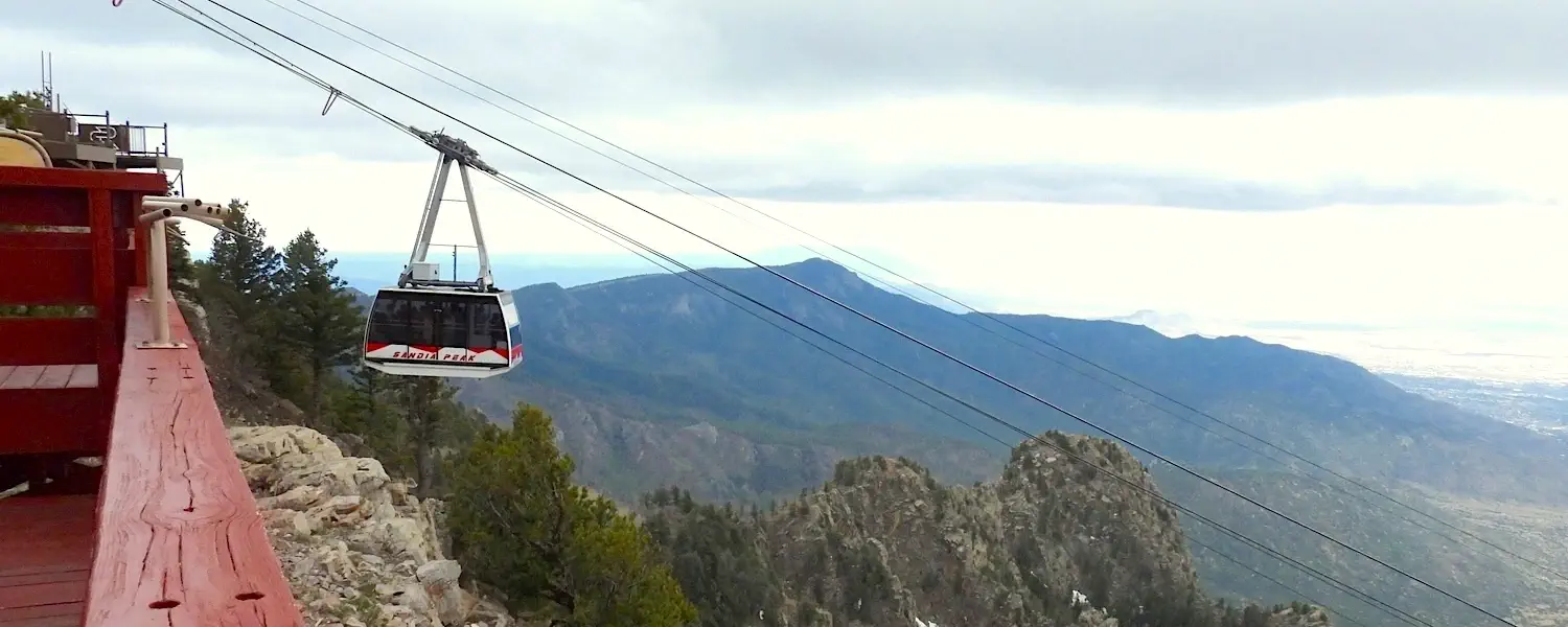
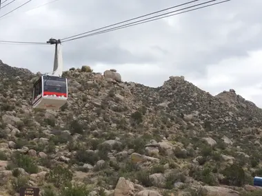
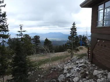
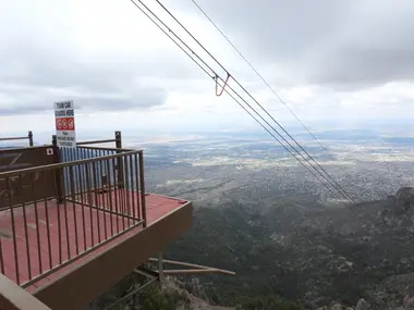
The Sandia Peak Tramway whisks you from the base station to the summit in just 15 minutes. As the tram glides up the mountainside, the desert landscape gradually gives way to sweeping vistas. Upon reaching the 10,378-foot peak, a breathtaking panorama unfolds, with Albuquerque stretching out below. On clear days, you can see as far as 11,000 square miles. It was cloudy the day that we were there but the views were still incredible.
We thought we were prepared for cooler temperatures at the summit (typically 20-30 degrees colder than the city), but we underestimated the wind chill. With gusts reaching up to 20 mph, our sweaters weren’t enough to keep us warm. Even in May, the air temperature was in the mid-30s Fahrenheit, but the wind chill made it feel like the high 20s.
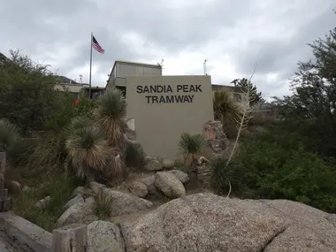
Sandia Peak Tramway Photos
Sandia Peak - Best Time to Visit?
- Summer (June to August): This is ideal for hiking, mountain biking, and enjoying the views. Temperatures are comfortable, ranging from the 60s to 80s°F (15-30°C) at the summit, and the trails are usually accessible.
- Fall (September to October): Fall offers cooler temperatures and beautiful fall foliage, especially in September and October. The International Balloon Fiesta in early October also attracts many visitors.
- Winter (December to February): If you enjoy winter sports, this is a great time for skiing and snowboarding. However, access may be limited due to snow and weather conditions.
- Spring (March to May): Spring is also a lovely time to visit, with blooming wildflowers and mild temperatures, though it can still be quite cool at the summit. Based on our experience with the cold morning temperature and windchill, shoot for afternoon to have the best chance for comfortable temperatures.
NOTE: If wind speed is higher than normal, the tramway will occasionally be closed until wind speeds diminish. You should visit the Tramway website for hours, any weather alerts, etc.
Hiking Trails at Sandia Peak
Sandia Peak offers several hiking trails, each with its own unique features and scenery. Here are some of the most popular trails:
La Luz Trail:
- Distance: Approximately 9 miles (one way).
- Difficulty: Moderate to strenuous.
- Description: This trail is a favorite among hikers, leading from the foothills to the summit of Sandia Peak. It offers stunning views of Albuquerque and the surrounding mountains. Some hikers choose to hike up and take the tram down while others choose to take the tram up and hike down. This is the most popular trail and takes 3 to 5 hours to hike down and 4 to 6 to hike up depending on your fitness level.
Sandia Crest Trail:
- Distance: About 1.5 miles (from the tramway summit).
- Difficulty: Easy to moderate.
- Description: Starting at the tramway summit, this trail provides a relatively easy hike with breathtaking views. It's a great option for those who want to enjoy the scenery without the strenuous effort of longer hikes.
Pino Trail:
- Distance: Approximately 5 miles (one way).
- Difficulty: Moderate.
- Description: This trail takes you through beautiful forests and offers lovely views, especially in the fall. It connects with other trails for extended hikes.
Bear Canyon Trail:
- Distance: Around 5 miles (one way).
- Difficulty: Moderate.
- Description: This trail follows Bear Canyon and offers beautiful scenery, including a variety of plant life and rock formations. It connects to the La Luz Trail.
Crest Trail:
- Distance: Varies, as it connects to multiple trails.
- Difficulty: Easy to moderate.
- Description: This trail runs along the crest of the Sandia Mountains, providing scenic views and access to several other trails.
Make sure to prepare yourself for hiking if you plan to hike in the area;
- Altitude: Altitude sickness is real and especially of concern for those traveling from much lower elevations. The elevation at Sandia Peak is over 10,000 feet, which can cause altitude sickness. Take time to acclimate, stay hydrated, and be aware of symptoms like headache, nausea, or dizziness.
- Weather Changes: Weather can change rapidly in the mountains. Be prepared for sudden drops in temperature, rain, or even snow. Check the forecast before heading out and dress in layers.
- Trail Conditions: Some trails may be rocky or steep. Wear sturdy hiking shoes with good traction, and be cautious on slippery or uneven terrain. Don’t do trails that are beyond your capabilities.
- Wildlife: Keep a safe distance from wildlife. Encounters with animals like bears or rattlesnakes are possible. Make noise while hiking to avoid surprising animals.
- Hydration and Nutrition: Bring plenty of water and snacks. Hiking at higher elevations can be more strenuous, and it’s easy to become dehydrated.
- Leave No Trace: Follow Leave No Trace principles to protect the natural environment. Pack out all trash and avoid disturbing plants and wildlife.
- Trail Navigation: Familiarize yourself with trail maps and signage. It’s easy to get lost, especially on longer hikes, so consider bringing a GPS device or a paper map.
- Emergency Preparedness: Have a plan for emergencies. Carry a first-aid kit, a whistle, and a fully charged cell phone. Let someone know your hiking plans and expected return time. Don’t go on a long hike without planning for emergencies.
Visiting Sandia Peak Map
Where is Sandia Peak located?
Sandia Peak is located just east of Albuquerque, It takes about 30 to 40 minutes to drive from Albuquerque International Sunport to the Sandia Peak Aerial Tramway entrance, depending on traffic. The distance is approximately 20 miles. It’s best to drive but there are public transportation options.
Sandia Peak Parking?
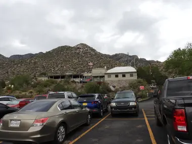
There is ample parking at the base of the tram station.
Sandia Peak Tramway Tickets?
Tickets range from $24 to $39 for round trip tickets and a one way ticket is $23. They have discounts for children, seniors and active military members. It is best to purchase tickets online at their website. Online tickets are available up to 30 days in advance. Due to varying weather conditions the tramway can close from time to time. When we arrived it was quite windy so we picked the day of our trip when the weather was supposed to be the best. We booked it just the day before we rode the tram. When we were there we weren’t worried about the crowds.
If you book in advance and weather forces a closure, then a refund will be provided upon request according to their website.
Eating Options at Sandia Peak?
There is a restaurant on the peak named "Ten 3" which offers dining with incredible views. They offer a diverse menu that includes locally inspired dishes and classic American fare. This would be a wonderful choice for a place to take a date. However, it does get very crowded and waits can be long. On very cold days people flock to the restaurant to stay out of the cold. We recommend that if you want to go to the restaurant, get your reservations in advance along with your tram pass. Arrive about an hour before your dining reservation to give you time to get to the top. Some people recommend arriving closer to sunset for the best views.
There is a small cafe at the base of the tram that serves lighter fare, including sandwiches, salads, and snacks which are great for a quick bite before or after your tram ride. See our link below for "restaurants near Sandia Peak Tramway" for a more complete list of options.
More Info for Sandia Peak Tramway
- Sandia Peak Tramway Website
- Sandia Peak Tramway Tickets - currently are $34 adult round trip (prices vary by age group). As weather can disrupt Tramway operations, you should go to their website to confirm pricing & availability:
- Sandia Peak Tramway Parking: there is a large parking lot immediately in front of the Tramway Building:
- Sandia Peak Tramway Wikipedia Article
- Restaurants near Sandia Peak Tramway
- Google Reviews for Sandia Peak Tramway
- Sandia Peak Tramway on Youtube
- Our Sandia Peak Tramway Image Gallery
- Sandia Peak Tramway Google Images Set
Image Credits
All of the above images are the property of Just Traveling Thru, LLC.
In the trip menu list below, a "dark filled circle" represents a destination where we stayed, and the "dark filled arrow" items below that circle location, represent the destinations we visited while in that city or location. A circle icon that is not filled represents a city that we visited or stayed in, but did not necessarily explore.
Click any link below to go directly to that page;
- Sandia Peak Tramway
- Petroglyph National Monument
- Old-Town Albuquerque
- National Museum of Nuclear Science & History
Alamogordo, NM
- Georgia O'Keeffe Museum, NM
- Museum of Indian Arts & Culture, NM
- Ojo Santa Fe Spa Resort, NM
- Bradbury Science Museum - Los Alamos, NM
- Los Alamos, NM
- Bandelier National Monument, NM
- Nambé Falls, NM
- Meow Wolf, NM
Chaco Culture National Historical Park, NM
Grand Canyon, AZ
Note: All images featured on this page are the exclusive property of Just Traveling Thru, LLC, unless otherwise stated. When images from external sources are used, full credit is given to the original creator, along with a link to the specified license or usage terms. We are committed to respecting copyright and intellectual property rights, ensuring that all third-party images are properly attributed. If you have any questions regarding image ownership or usage rights, please feel free to contact us.
To review any of our content, make suggestions and/or comments, please click the "About" menu link at the top of this page. You will find our "Contact Us" link on that drop-down menu.

