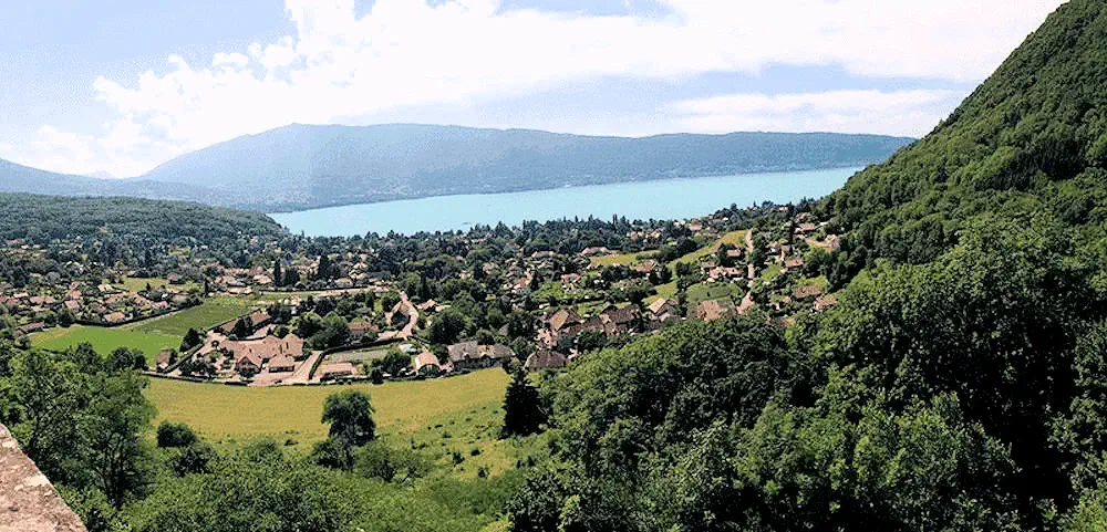
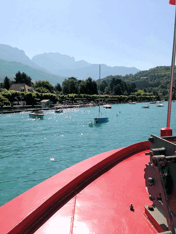
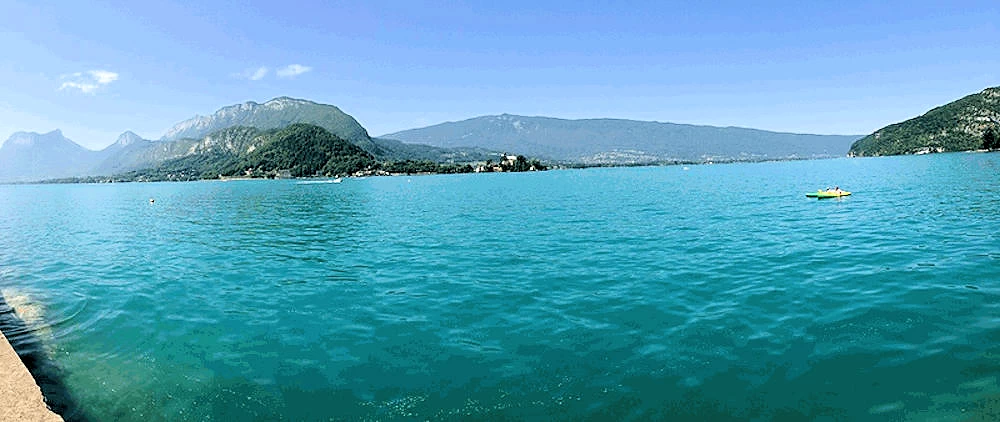
Lake Annecy France
Experience the Magic of France's Most Stunning Lake
by Celeste Lipford and Terry Lipford - last updated on 4/1/2025
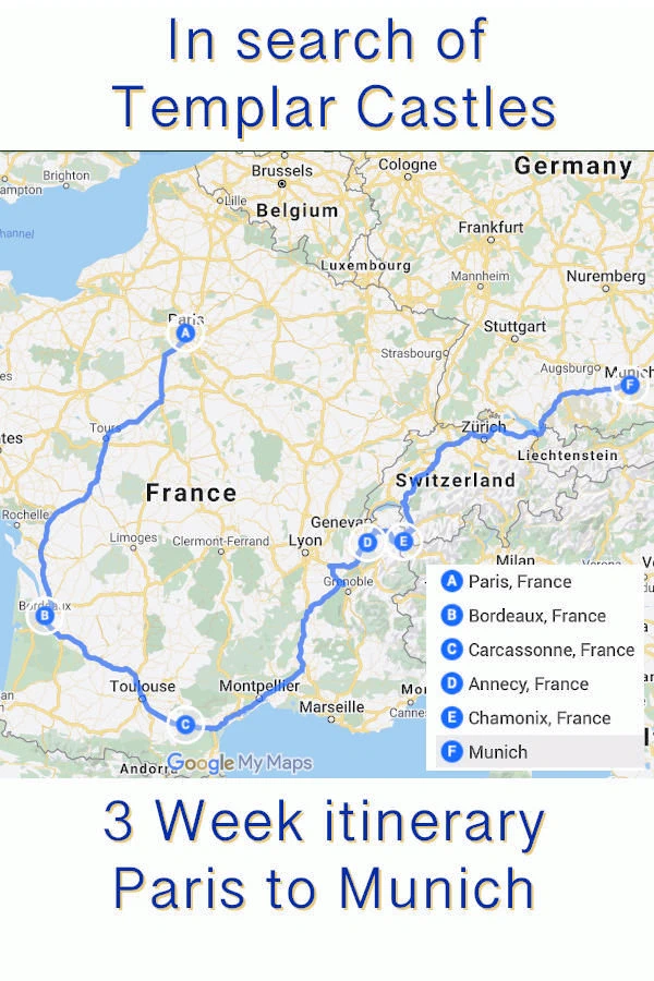
For those of you who are not familiar with Annecy, it sits at the northern end of Lake Annecy, and is approximately 150 kilometers east of Lyon, France and 42.5 kilometers south of Geneva, Switzerland. During research for our 2013 European Trip, we knew that we were going to drive from Carcassonne to Munich (1,175 kilometers) and that the amount of driving time was much more than we wanted to endure in a single day.
So we started looking at locales that would be good to break the trip into two drives, and we decided on Lake Annecy. In part because we found some interesting places to visit there, and in part because of it's proximity to Chamonix and Mont Blanc. Once we realized how beautiful the Lake Annecy area was, we decided to increase our overall timeline in Europe so that we could spend 5 days in Annecy.
From Carcassonne we got to Annecy around dinner time (560 kilometer drive), and once again, our Tom-Tom navigation device (an old school stand-alone navigation device that was popular before true mapping Applications became a reality on cellphones and laptops) that we had named "Suzette", was able to navigate us through city streets that would have been difficult without assistance. We were bound for the Annecy Adagio Centre, and given the number of one way streets and round-abouts, a Tom-Tom (or some type of mapping system) is a very necessary tool to have!
Lake Annecy Facts
- What are the dimensions of Lake Annecy?
Maximum Length: 14.6 km (9.1 miles).
Maximum Width: 3.2 km (2.0 miles).
Surface Area: 27.59 km² (10.66 square miles).
Maximum Depth: 82 meters (269 feet).
Average Depth: 41 meters (135 feet).
Water Volume: 1.15 km³ or 1,124.5 million cubic metres (911,600 acre feet).
Lake Annecy is renowned for its exceptionally clean and clear waters, thanks to strict environmental regulations. It is a popular destination for water sports, cycling, and hiking, surrounded by picturesque Alpine scenery.
- What is the Lake Annecy Overview?
It is the third largest lake in France, after the Lac du Bourget and Lac de Grand-Lieu, if the French part of Lake Geneva (which is shared between Switzerland and France) is excluded. It is known as "Europe's cleanest lake" because of strict environmental regulations introduced in the 1960s. It is a popular tourist destination known for its swimming and water sports.
- What is a brief history of Lake Annecy?
The lake was formed about 18,000 years ago, at the time the large alpine glaciers melted. It is fed by many small rivers from the surrounding mountains (Ire, Eau morte, Laudon, Bornette and Biolon), and from a powerful underwater source, the Boubioz, which enters at a depth of 82 meters.
- Is Lake Annecy one of the cleanest lakes in France?
Yes, Lake Annecy is often called the cleanest lake in Europe due to strict environmental protections implemented in the 1960s, which have kept its waters exceptionally pure.
- Is Lake Annecy one of France's Largest Lakes?
Yes, it is the third-largest lake in France (excluding Corsica), spanning 27.4 square kilometers (10.6 square miles) with a depth of up to 82 meters (269 feet).
- Has Annecy been a popular filming location for movies or TV shows?
Yes, Lake Annecy has been featured in films and TV shows, including "The Bear" (1988) by Jean-Jacques Annaud and "Point Break" (2015) as a backdrop for extreme sports scenes. Click here to view the complete list on the IMDB Website.
- Is the Annecy area good for Outdoor Activities?
Yes, The lake is a hub for watersports, including swimming, kayaking, paddleboarding, and sailing. In addition, the 40-kilometer (25-mile) cycling path around the lake is a favorite for cyclists.
Where to Stay in Annecy
As of 2025, Annecy, France, offers a diverse range of accommodations to suit various preferences and budgets. According to Booking.com, there are approximately 213 hotels and places to stay in Annecy, including hotels, bed and breakfasts, and other lodging options.
These accommodations range from budget-friendly hotels to luxurious châteaux, providing options for all types of travelers. Whether you're seeking a centrally located hotel in the historic city center or a serene retreat in the surrounding countryside, Annecy has a variety of lodging choices to enhance your visit.
As of 4/13/2025 and according to Google Review Ratings, here are the top five most popular accommodations in Annecy;
- Hôtel du Château: Across the street from the
Château d'Annecy, this relaxed stone hotel is 7 minutes' walk from Lac d'Annecy and 9 minutes' walk from Gare d'Annecy train station.
Google Review Rating 4.5 based upon 396 reviews
- Le Clos Des Sens: Set 3 km from Plage D’Albigny on Lac d’Annecy, this
luxe hotel and acclaimed restaurant in former school is 4 km from both Palais de l’Isle museum and Annecy train station.
Google Review Rating 4.7 based upon 822 reviews
- Hôtel Le Pélican: Off a bustling road with views
of Lake Annecy, this genteel hotel is a 14-minute walk from the Basilique de la Visitation and 1 km from Annecy train station.
Google Review Rating 4.6 based upon 981 reviews
- Rivage Hôtel & Spa Annecy: Suburban area
edging Lake Annecy, with Plage d’Albigny city beach, waterside bars & walking trails.
Google Review Rating 4.6 based upon 2,100+ reviews
- Hotel and Restaurant La Maison Bleue: Overlooking Lac d'Annecy, this
woodsy, upscale hotel in an ornate mansion is 6 km from the medieval Château de Menthon-Saint-Bernard and 6 km from Gare d'Annecy train station.
Google Review Rating 4.7 based upon 746 reviews
While researching accommodations for our trip to Annecy, we carefully considered several options, keeping in mind our priorities. We wanted a place that offered secure parking, was conveniently located near dining options, and provided easy access to the lake and other key attractions we planned to visit. After evaluating our choices, we decided on the Aparthotel Adagio Annecy Centre, which stood out due to its excellent amenities and practical design.
One of the main highlights of this aparthotel was its apartment-style suites, which provided the perfect balance of comfort and functionality. Each suite featured a small but well-equipped kitchen, allowing us the flexibility to prepare our own meals when we preferred a quiet night in. This was particularly convenient for longer stays or for those who appreciate the option of self-catering.
Additionally, the hotel’s central location made it an ideal base for exploring Annecy. We found it easy to walk to the picturesque old town, the lakefront promenade, and numerous charming cafés and restaurants. The secure on-site parking was another major advantage, as it gave us peace of mind and allowed us to venture out on day trips without worrying about finding a safe place to park upon our return.
Overall, our stay at Aparthotel Adagio Annecy Centre met our expectations and provided a great combination of convenience, comfort, and accessibility. It was an excellent choice for travelers looking for a well-situated accommodation with the added benefit of self-catering facilities.
If you would prefer to perform your own accommodations research, click here to view a Google Search Results list of all of them. Note that you can change the "search filters" for whatever results you require, ie; sort by price, by # of stars, has a pool, etc.
Image Credits:
- Image Credit: Image # 1 is the property of Aparthotel Adagio Annecy Centre
- Image Credit: Image # 2 is the property of Trip.Com
Where to eat in Annecy
Annecy boasts a vibrant culinary scene that caters to diverse tastes. Here are five of the most popular restaurants in Annecy, based upon Google Review Ratings:
-
Tête de Cochon: Tête de Cochon, located
in the bustling street of old town Annecy, is a gem of a brasserie that serves up delicious tartines and salads made with fresh, local ingredients. The
establishment boasts a jovial and welcoming atmosphere, with staff who are both accommodating and humorous.
Google Reviews Rating 4.8 based upon 1,500+ reviews
-
Le Bistro du Rhône: Creative cooking with seasonal ingredients
from surrounding mountains, in an arty modern space.
Google Reviews Rating 4.8 based upon 1,100+ reviews
-
Haven: Warm restaurant with outdoor seating serving Australian-style brunch & lunch offerings.
Google Reviews Rating 4.6 based upon 1,300+ reviews
-
Le Denti: Innovative, upscale dishes & fine wines offered in an unpretentious environment.
Google Reviews Rating 4.9 based upon 925+ reviews
-
COZNA: Cozy, relaxed restaurant with a local menu highlighting
reimagined meat plates, seafood & desserts.
Google Reviews Rating 4.8 based upon 709+ reviews
If you would like to perform your own restaurant research, here is a link to a Google Search Results list of all Annecy restaurants.
Gorges du Fier Map
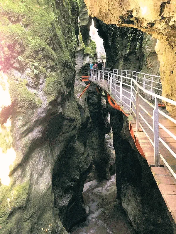
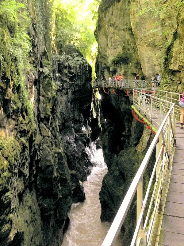
This was our first "day trip" from Annecy, and it was propelled by our trip research. This is an amazing gorge, with the River du Fier rushing through the rocks below. It is only 12.1 kilometers from Annecy, however, the route is all rural two lane roads that twist & turn frequently. Very pretty area, but impossible to transit at any speed - you should plan your drive accordingly.
Our route from our Annecy Hotel to the Gorges du Fier; Route de Chavaroche to Route de Bellville to Route de Chavaroche. As this route involves multiple round-a-bouts, it is suggested that your "navigator" have a map Application up & running!
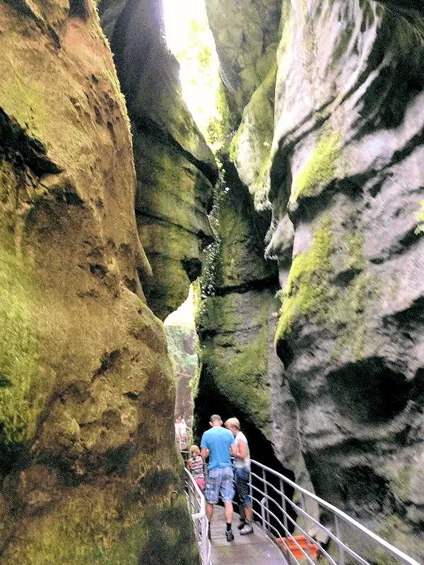
The Gorges du Fier in France is a geological marvel, a breathtaking natural spectacle carved by the Fier River over thousands of years. Just outside Annecy, this narrow canyon showcases towering limestone cliffs, reaching up to 25 meters in height, and the river's turquoise waters flowing dramatically through its depths. Visitors traverse the gorge on a suspended footbridge, providing an awe-inspiring vantage point to witness the power of nature at work. The journey unfolds along winding paths and tunnels, revealing the sheer force that sculpted the canyon's intricate formations.
The catwalk is solidly attached to the rocky sides of the gorge, perhaps 50 feet above the river below. There is barely enough room for a person to walk forward, with wider areas to allow people to return to the starting point. If people are attempting to walk back the other way, you are required to turn your back to the cliff face and give them as much room as you can.
More Info for Gorges du Fier
Image Credits:
- All the above images are the property of Just Traveling Thru, LLC, unless otherwise noted.
Le Thiou River
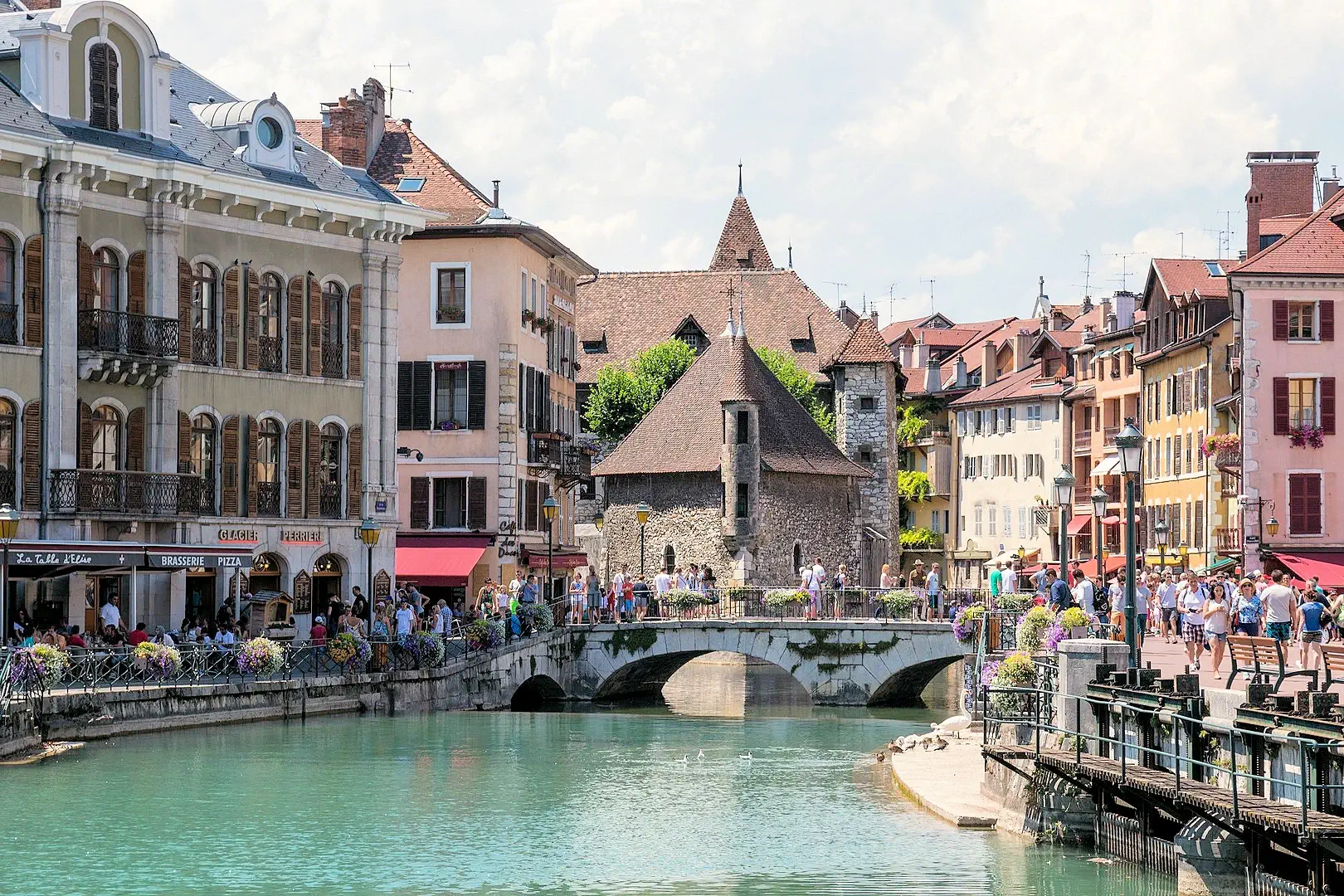
Look at these beautiful central Annecy scenes! Annecy has been called the "Venice of the Alps"; the winding cobblestone streets lined by pastel houses and bright flower boxes will make you fall in love with this small French town.
The Thiou River is considered to be the shortest river in France with its 3.5 km of length and forming a maze of canals in Annecy, that contribute to the beauty of the "Venice of the Alps".
NOTE: Image # 1 is the property of Dmitry A. Mottl via Wikimedia Commons using the Creative Commons Attribution-Share Alike 4.0 International license. Image # 2 is the property of Just Traveling Thru, LLC.
Jardins de l'Europe ("The Gardens of Europe")
After lunch, we had gone to the park to play some frisbee, and decided afterwards to hike around the park on the Quai Napoleon III. This image is from the north side of the park near the Pont des Amours.
The gardens are meticulously landscaped, featuring a variety of plant species, colorful flower beds, and winding pathways. A central fountain provides a tranquil ambiance, while benches offer opportunities for relaxation. The gardens are a popular spot for locals and tourists alike, providing a picturesque setting for picnics, leisurely walks, or simply enjoying the natural beauty of Annecy. With stunning views of the lake and the surrounding mountains, the Jardins de l'Europe is a must-visit destination for anyone seeking a peaceful retreat in this charming French city.
Beyond the mountains on the eastern side of Lake Annecy, is the Chamonix Valley area of France - which includes Mont Blanc.
More Info for Jardins de l'Europe
Image Credits:
- Image # 2 is the property of Florian Pépellin via Wikipedia Commons using the CC-BY-SA 3.0 license.
- All other images, unless otherwise noted, are the property of Just Traveling Thru, LLC.
Plage du Plant
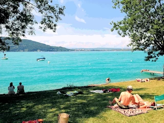
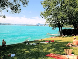
Lake Annecy is surrounded by a number of small public beach/park areas, providing a nice place to go for a quick swim and a picnic at lunch time. The lake and the town were so scenic and interesting, everything exceeded our expectations.
The Lake Annecy water was so blue that I thought we were in the Caribbean - we jokingly thought the lake might be died that color! You can swim in the water from anywhere around the lake, as there are multiple beaches. I had never imagined such a place, it was beautiful and we were glad to have taken the time to explore here.
The above pictures were taken at Plage du plant as we drove down the eastern side of the lake on French Route D909A headed towards Chateau Menthon Saint-Bernard.
More Info for Plage du Plant
Image Credits:
- All the above images, unless otherwise noted, are the property of Just Traveling Thru, LLC.
Old Town Annecy
 Palais de l’Île
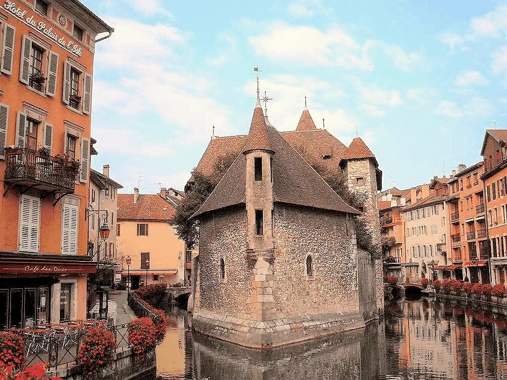
The Palais de l’Île is a 12th century castle on an island in the River Thiou in Annecy. It mostly served as a prison and courthouse until the French Revolution and was again used a prison during World War II.
The Palais de l'Île has a triangular shape due to its location on a narrow, natural island formed by the branching of the Thiou River in Annecy. The building was designed to fit the unique contours of the island, which resulted in its distinctive triangular form. This strategic design also served defensive purposes when the building functioned as a fortress and later as a prison. The shape is a key element that adds to its historical and architectural significance.
 Château d'Annecy
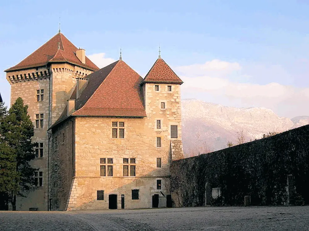
The Château d'Annecy was built between the 12th and 16th centuries and served as the residence of the Counts of Geneva and the Dukes of Genevois-Nemours. Several times the victim of fires, the castle was abandoned in the 17th century and later repaired to serve as a barracks until 1947. The town of Annecy acquired the castle in 1953, restored it with the help of Monuments historiques and installed a museum there.
Since 1993, the Tower and the Logis Perrière have housed an observatory (l'Observatoire régional des lacs alpins).
 Palais de l’Île
The fortified Palais de l’Île was built on a natural rocky island in the 12th century and was referred to for the first time in 1325 as a prison when the feudal lord of Annecy paid Jean de Menthoux, the master of the island, to feed two prisoners.
During the French Revolution and until 1865, the castle continued its notorious prison role whilst also housing barracks for the passing troops. Between 1865 and 1880, it served as an old peoples’ home before being turned back to a barracks. There were attempts to raze the building but the excessive cost involved prevented any action being taken. It was saved by being listed as an Historical Monument by the French State in 1900.
More Info for Old Town Annecy
Image Credits:
- Image # 1 is the property of Paul Hermans via Wikimedia Commons using the CC BY-SA 4.0 Creative Commons license.
- Image # 2 is the property of Kemper Boyd via Wikimedia Commons using the CC BY 3.0 Creative Commons license.
- Image # 3 is the property of Dmottl via Wikimedia Commons using the CC BY 4.0 Creative Commons license.
- All other images, unless otherwise noted, are the property of Just Traveling Thru, LLC.
Château de Menthon-Saint-Bernard
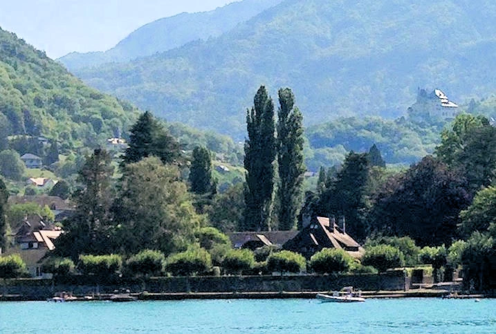
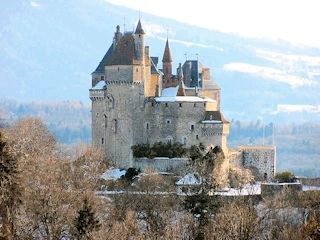
We took image # 1 while we were on the boat tour around the Lake, and as the boat crew provided some amount of narration as to what we were seeing, this is how we found out what this chateau was all about. The chateau buildings (center right of image #1) are all original, and were built between the 13th and 19th centuries. It was this view and some later research that we did to find out more about the Chateau, that made us to decide to drive here the next day. In the distance in the right center area of this image, is the Château de Menthon-Saint-Bernard.
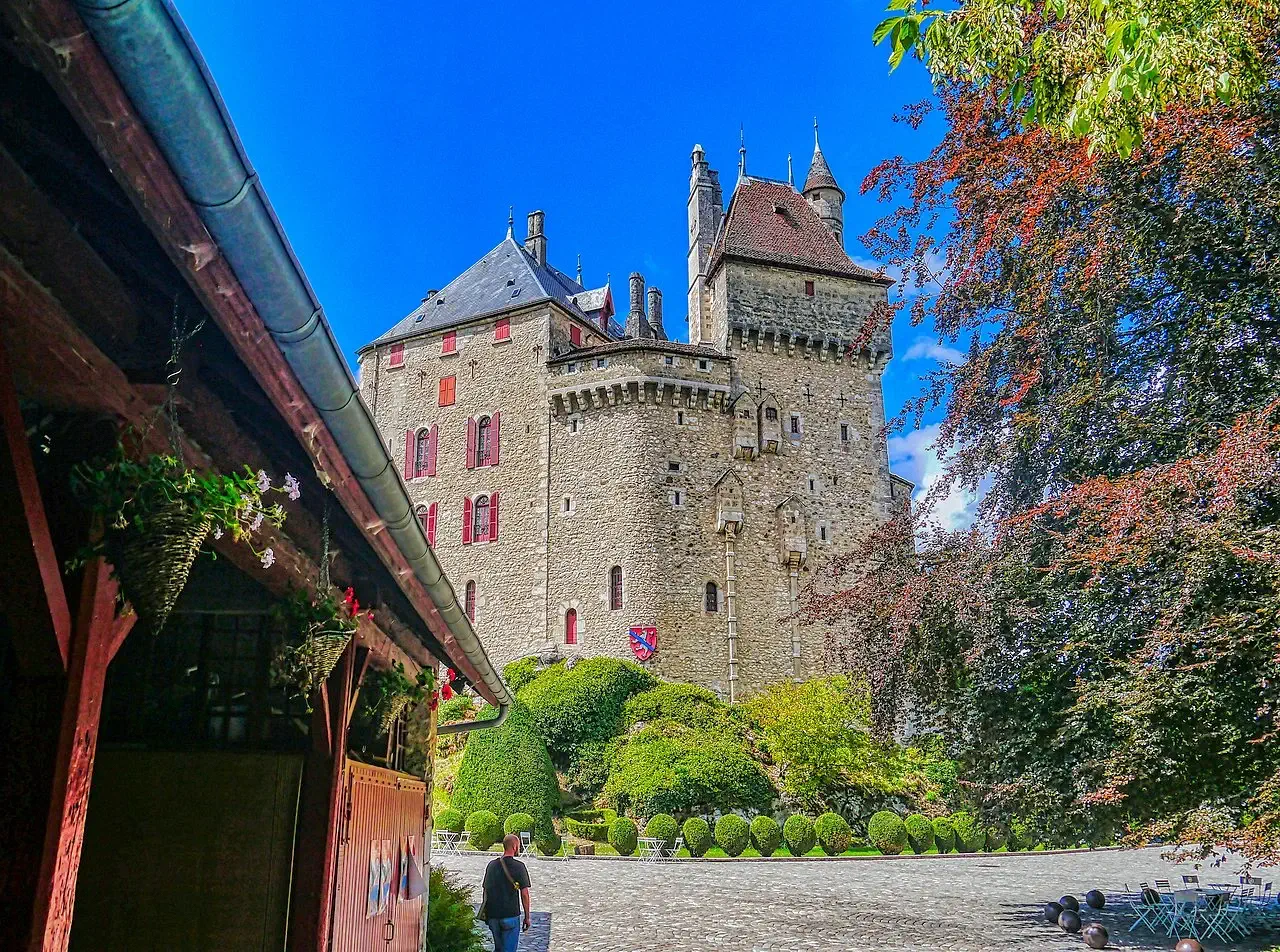
Image # 2 is the courtyard of the Chateau, just to the left is the general parking area.
Image # 3 is the view you get as you drive up the hill to reach the Chateau parking lot, we missed taking our own picture because we were busy navigating! You have to admit that it is a stunning example of a Chateau.
Image # 4 is the view you get looking down into the valley from the Chateau parking lot.
Château de Menthon-Saint-Bernard Quick History Lesson: The Château de Menthon is a medieval castle located in the commune of Menthon-Saint-Bernard, 12 kilometers (7.5 miles) south of Annecy in the Haute-Savoie department of France. Standing on a 200 metres (660 feet) tall rock, its stone towers loom over Lake Annecy, the Roc de Chère National Nature Reserve, and Menthon-Saint-Bernard. Since 1989, it has been listed as a monument historique by the French Ministry of Culture.
Bernard of Menthon (St Bernard), the patron saint of skiers, was born in this castle in the 11th century (1008). He later founded the hospice at the Great St. Bernard Pass Abbey in the high mountains. It is at that Abbey where the St. Bernard dog breed originates from.
More Info for Château de Menthon-Saint-Bernard
Image Credits:
- Image # 1 is the property of Just Traveling Thru, LLC.
- Image # 2 is the property of Zairon via Wikimedia.
- Image # 3 is the property of CMIvisavoy via Wikimedia.
- All other images, unless otherwise noted, are the property of Just Traveling Thru, LLC.
Lake Annecy Boat Tour 3D Map
The next day after our Chamonix adventure, we decided to explore the area around Lake Annecy, specifically the areas on the east side of the Lake. We had discovered that the Lake Annecy boat tour would take us to an area that looked like it might be good for hiking.
One of the things we wanted to accomplish on the Lake Annecy boat tour, was to disembark at the Talloires pier and trek up to the Cascade d'Angon (Waterfalls of Angon). When we researched the hike, it seemed very doable at a distance of just under 3 kilometers and approximately 45 minutes from the Talloires pier - and - the images of the waterfall were beautiful!
That first image displays what the trail was like; very rocky and a continously steep ascent. As one of our party did not have on good hiking shoes, plus it was very hot that day, we decided to come back down the trail (after getting to the halfway point) to reboard the boat tour at the Angon pier (3rd picture). The end result was that we got there "too quickly" (next boat wasn't due for 2.5 hours) and we were all hungry and since the Restaurant L'Aquarama was immediately next to the pier, we decided to have lunch there.
Lunch was very good, you might want to give this place a try if you are ever in this area of France.
As the boat tour progressed, it began to be clearer & clearer what a beautiful area Lake Annecy was! The first image above is Chateau de Duingt as the tour boat approached. Image 3 shows how everyone huddled out of the sun, because it was still a very hot day! And image 2 shows the tour boat slowing to tie up at the small village near Chateau de Duingt.
Boat Tour Headed back to Annecy 3D Map
As the tour boat continued north back to Annecy, the views of the lake and shoreline continued to inspire everyone onboard to take a lot of pictures!
When the tour boat stopped in the village of Duingt, we were able to see the Roc de Chère National Nature Reserve on the other side of the lake.
Train Overpass outside Chamonix
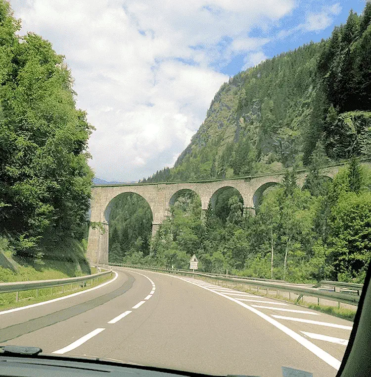
We discovered this bridge overpass on the French N-205/A-40 route as we returned to Annecy from a day trip to Chamonix. It looks very Roman doesn't it? This particular bridge is for the Mont-Blanc Express coming into Chamonix.
Click here for the Wiki page listing various Roman constructions. And just as an added point to ponder, the Romans invented concrete to solve the issue of building piers & docks that would endure longer even though the construction took place "in the water".
Some Useful Links
- Google Reviews: for Annecy, France
- Things to do in Annecy on the "Get Your Guide" site
- Annecy History on the "French Moments" site" (good history lesson)
- Britannica Annecy Page
- Things to do & see in Annecy on the "Crazy Tourist" site
- Annecy History on the "Ancient Origins" site" (another good history lesson)
- Top Ten Restaurants in Annecy on the "Culture Trip" site
- Top Ten Brunch Spots in Annecy on the "Culture Trip" site
- Annecy Google Travel Guide
- Google Search Results list for "places to eat in Annecy"
- Google Search Results list for "accommodations in Annecy"
- Amazon Search Results list for "books about Lake Annecy"
- Youtube Search Results list for Annecy
- Visit our Youtube Channel
The following list contains links to all of our other French Destinations & Information Pages, click any link to go to that page.
Note: All images featured on this page are the exclusive property of Just Traveling Thru, LLC, unless otherwise stated. When images from external sources are used, full credit is given to the original creator, along with a link to the specified license or usage terms. We are committed to respecting copyright and intellectual property rights, ensuring that all third-party images are properly attributed. If you have any questions regarding image ownership or usage rights, please feel free to contact us.
To review any of our content, make suggestions and/or comments, please click the "About" menu link at the top of this page. You will find our "Contact Us" link on that drop-down menu.


