by Celeste Lipford and Terry Lipford - last updated on 10/9/2025

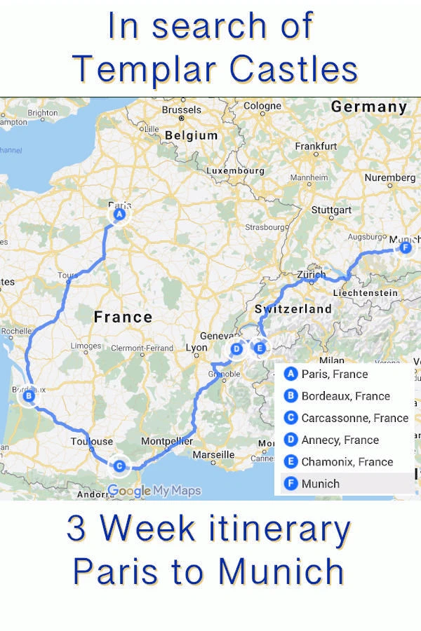
After some further adventures in and around Carcassonne & Rustiques, we repacked the Renault, and headed off to Annecy. This was easily the longest drive so far, at 560 kilometers, we knew we had to get out on the autoroute early.
Our drive from Rustiques to the Pont du Gard was 227 kilometers via the A9 auto route. We had researched this destination and knew that stopping to see the Pont du Gard was well worth the time, so we made a very early departure from Rustiques.
This is a huge structure, 160 feet in height, 20 feet in width and was constructed by Roman Engineers nearly 2,000 years ago to carry water from Fontaine d'Eure to the Roman colony at Nimes, France.
The Pont du Gard is a remarkably preserved ancient Roman aqueduct bridge located in southern France, near the city of Nîmes. Recognized as a masterpiece of human creative genius, this tri-level stone structure was designed to transport fresh water over a distance of approximately 50 kilometers (31 miles), crossing the Gardon River valley. Built without mortar during the mid-1st century CE, its exceptional longevity and structural integrity are a testament to the advanced engineering skills of its Roman creators.
Constructed during the Augustan age, the aqueduct's main function was to supply the flourishing Roman city of Nemausus (modern-day Nîmes) with a constant flow of potable water from the Eure springs near Uzès. The city's population boom required a reliable water source for its baths, fountains, and private homes. The genius of the project lies in the hydraulic engineering that allowed water to travel primarily by gravity, with an astonishingly small and constant gradient over its entire length. This enabled the aqueduct to deliver an estimated 40,000 cubic meters of water per day, highlighting the Romans' mastery of hydraulic principles. The aqueduct was in active use for about five centuries before lack of maintenance led to its eventual disuse around the 6th century.
The bridge itself is a stunning work of architecture, with its three tiers of arches rising nearly 50 meters (164 feet) high. It was constructed from locally sourced shelly limestone, with blocks—some weighing up to six tons—cut so precisely that they fit together and hold their position through gravity alone. The bottom tier has six arches spanning the river, the middle tier has eleven, and the top tier, which originally contained 47 smaller arches, housed the covered water conduit. Beyond its initial function, the Pont du Gard served a secondary purpose as a toll bridge during the Middle Ages, which helped ensure its preservation. Today, it is a UNESCO World Heritage site, admired not only for its historical significance and technical brilliance but also for its seamless integration into the natural Mediterranean landscape.
Construction of the entire aqueduct system spanned roughly 10 to 15 years, under the reigns of Emperors Claudius and Nero, with the Pont du Gard itself completed in under five years. The full aqueduct includes tunnels, basins, and more than twenty bridges, but the Pont du Gard is by far the most spectacular and well-preserved segment. Stretching over 275 meters long and standing nearly 50 meters high, it remains the tallest Roman aqueduct bridge ever built.
Having explored Roman ruins across Italy and other parts of Europe, we found the Pont du Gard to be particularly awe-inspiring. The craftsmanship is exceptional: each massive limestone block appears to have been cut and placed with incredible precision, leaving almost no gaps between stones—even though no mortar was used. Walking across the pedestrian bridge just below the aqueduct, you can closely observe the flawless alignment of the arches and the sheer scale of the construction.
The numbers behind it are equally impressive: the structure used over 21,000 cubic meters of stone, weighing an estimated 50,400 tons. One of its most remarkable features is the 25-meter span between its arches, which was among the widest in the Roman world at the time. It’s no wonder that this site continues to captivate engineers, architects, and history enthusiasts from around the globe.
Pont du Gard UNESCO Site
If you are interested in this UNESCO site, click here to view our French UNESCO Sites Page.The following list contains links to all of our other French Destinations & Information Pages, click any link to go to that page.
Note: All images featured on this page are the exclusive property of Just Traveling Thru, LLC, unless otherwise stated. When images from external sources are used, full credit is given to the original creator, along with a link to the specified license or usage terms. We are committed to respecting copyright and intellectual property rights, ensuring that all third-party images are properly attributed. If you have any questions regarding image ownership or usage rights, please feel free to contact us.
Affiliate Links: We may earn a commission if you make a purchase through one of our affiliate links. This helps support our travel content — thank you!
Content: To review any of our content, make suggestions and/or comments, please click the "About" menu link at the top of this page. You will find our "Contact Us" link on that drop-down menu.